
Magnitude |
:2.5 |
| Date & Time (UTC) | 2015-01-24 17:34:10.2 |
| Date & Time (Local) | 1393/11/4 21:04:10.2 |
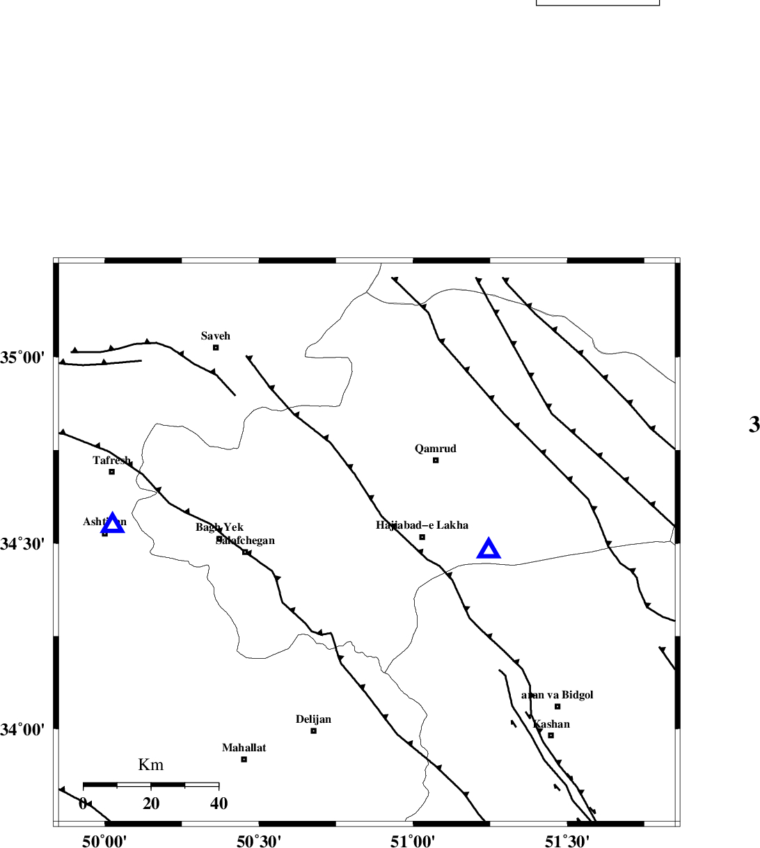
| Location | Lat:34.5 Lon: 50.85 |
| Region | Qom Province, 16 km South of Qom |
Nearest Cities |
|
| 14 km North of Kahak, Qom Province | |
| 17 km West of Hajiabad-e lakha, Qom Province | |
| 17 km South of Qom, Qom Province | |
| 32 km South West of Qamrud, Qom Province | |
| 34 km North West of Yahyaabad, Esfahan Province | |
| Depth | 14 km |
| Agency | |
Faults within 150 km: |
|
| INDES_F (Length: 98 km) , Distance to epicenter: 28 km | |
| KUSHK_E_NOSRAT_F (Length: 230 km) , Distance to epicenter: 41 km | |
| KASHAN_F (Length: 44 km) , Distance to epicenter: 55 km | |
| Number of Phases | 4 |
| RMS | 0 |
| Number of Stations | 4 |
| Error in Latitude | >2.9 km |
| Error in Longitude | 3 km |
| Error in Depth | 87.4 km |
Download waveform in seisan format
to download seisan software Click here
to access information about IIEES stations Click here
Amplitude | ||||||||
| UID | Agency | Station | Component | Amplitude | Period | Arrival Time | Proccessing Time | Signal Clip |
| 94857 | IIEES | GHVR | N | 345.4 | 0.2 | 2015-01-24 17:34:24 | 2015-01-24 06:30:00 | n |
| 94858 | IIEES | DAMV | E | 130 | 0.08 | 2015-01-24 17:34:57 | 2015-01-24 06:30:00 | n |
Phase | ||||||||||||
| Agency | Station | Component | Phase Type | Phase Quality | First Motion | Observed Arrival Time | Time Residual | Loc. Flag | Input Weight | Distance | Azimuth | |
| IIEES | GHVR | Z | Pg | E | 2015-01-24 17:34:17 | -0.02 | y | 36.1 | 94 | |||
| IIEES | ASAO | Z | Pg | E | 2015-01-24 17:34:23 | -0.03 | y | 76.2 | 274 | |||
| IIEES | KHMZ | Z | Pg | E | 2015-01-24 17:34:30 | 0.03 | y | 118 | 224 | |||
| IIEES | DAMV | Z | Pg | E | 2015-01-24 17:34:37 | 0.02 | y | 161 | 39 | |||