
Magnitude |
:3.3 |
| Date & Time (UTC) | 2015-01-21 21:20:50.8 |
| Date & Time (Local) | 1393/11/2 00:50:50.8 |
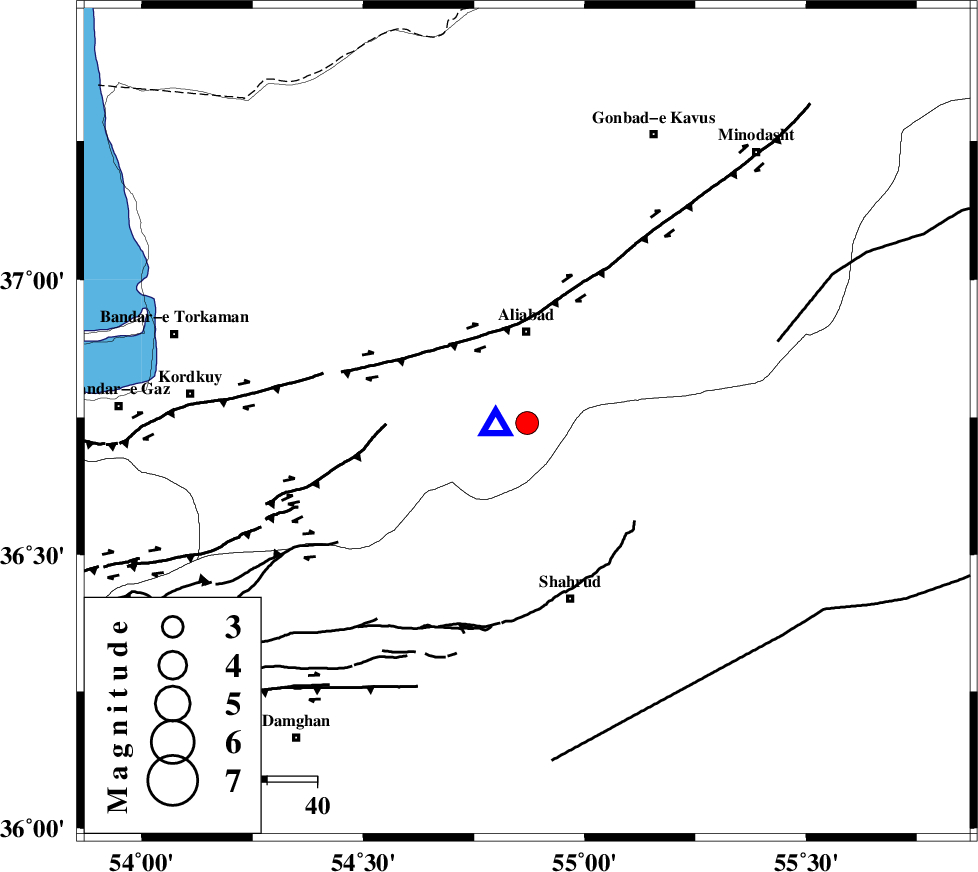
| Location | Lat:36.74 Lon: 54.87 |
| Region | Golestan Province, 18 km South of Ali Abad |
Nearest Cities |
|
| 18 km South of Ali Abad, Golestan Province | |
| 24 km North West of Qaleh-ye nokharqan, Semnan Province | |
| 31 km South East of Jalin olia, Golestan Province | |
| 31 km North West of Bastam, Semnan Province | |
| 32 km South West of Khanbebin, Golestan Province | |
| Depth | 14 km |
| Agency | |
Faults within 150 km: |
|
| SHAVAR_F (Length: 87 km) , Distance to epicenter: 19 km | |
| KHAZAR_F (Length: 523 km) , Distance to epicenter: 31 km | |
| ASTANEH_F (Length: 72 km) , Distance to epicenter: 37 km | |
| Number of Phases | 6 |
| RMS | 0.1 |
| Number of Stations | 6 |
| Error in Latitude | >3.3 km |
| Error in Longitude | 2.2 km |
| Error in Depth | 7.2 km |
Download waveform in seisan format
to download seisan software Click here
to access information about IIEES stations Click here
Amplitude | ||||||||
| UID | Agency | Station | Component | Amplitude | Period | Arrival Time | Proccessing Time | Signal Clip |
| 94843 | IIEES | DAMV | E | 119.4 | 0.44 | 2015-01-21 21:22:14 | 2015-01-21 09:49:00 | n |
| 94844 | IIEES | THKV | N | 62 | 0.44 | 2015-01-21 21:22:47 | 2015-01-21 09:49:00 | n |
Phase | ||||||||||||
| Agency | Station | Component | Phase Type | Phase Quality | First Motion | Observed Arrival Time | Time Residual | Loc. Flag | Input Weight | Distance | Azimuth | |
| IIEES | BJRD | Z | Pn | E | 2015-01-21 21:21:29 | 0.14 | y | 249 | 64 | |||
| IIEES | BJRD | E | Sg | E | 2015-01-21 21:22:01 | -0.1 | y | 249 | 64 | |||
| IIEES | DAMV | Z | Pn | E | 2015-01-21 21:21:34 | 0.02 | y | 288 | 246 | |||
| IIEES | CHTH | Z | Pn | E | 2015-01-21 21:21:41 | -0.07 | y | 348 | 256 | |||
| IIEES | TABS | Z | Pn | E | 2015-01-21 21:21:48 | -0.09 | y | 399 | 148 | |||
| IIEES | SHRT | Z | Pn | E | 2015-01-21 21:22:13 | 0.12 | y | 601 | 123 | |||