
Magnitude |
:2.8 |
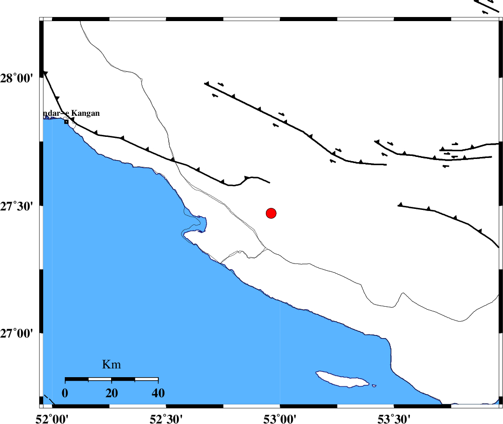
| Date & Time (UTC) | 2015-01-16 20:25:55.3 |
| Date & Time (Local) | 1393/10/26 23:55:55.3 |
| Location | Lat:27.47 Lon: 52.96 |
| Region | Fars Province, 11 km Mehr |
Nearest Cities |
|
| 3 km North of Khoozi, Fars Province | |
| 11 km of Mehr, Fars Province | |
| 17 km South of Alamarvdasht, Fars Province | |
| 20 km South East of Ardavan-e olia, Fars Province | |
| 21 km North East of Chah-e mobarak, Bushehr Province | |
| Depth | 18 km |
| Agency | |
Faults within 150 km: |
|
| MFF3 (Length: 292 km) , Distance to epicenter: 17 km | |
| LAR_F (Length: 99 km) , Distance to epicenter: 93 km | |
| QIR_F (Length: 130 km) , Distance to epicenter: 96 km | |
| Number of Phases | 5 |
| RMS | 0.1 |
| Number of Stations | 4 |
| Error in Latitude | >5.4 km |
| Error in Longitude | 3 km |
| Error in Depth | 6.8 km |
Download waveform in seisan format
to download seisan software Click here
to access information about IIEES stations Click here
Amplitude | ||||||||
| UID | Agency | Station | Component | Amplitude | Period | Arrival Time | Proccessing Time | Signal Clip |
| 94806 | IIEES | KRBR | N | 10.1 | 0.44 | 2015-01-16 20:27:58 | 2015-01-16 08:57:00 | n |
| 94807 | IIEES | KRBR | E | 11.1 | 0.52 | 2015-01-16 20:28:01 | 2015-01-16 08:57:00 | n |
Phase | ||||||||||||
| Agency | Station | Component | Phase Type | Phase Quality | First Motion | Observed Arrival Time | Time Residual | Loc. Flag | Input Weight | Distance | Azimuth | |
| IIEES | AHRM | Z | Pn | E | 2015-01-16 20:26:30 | 0.02 | y | 224 | 314 | |||
| IIEES | AHRM | E | Sg | E | 2015-01-16 20:26:58 | 0 | y | 224 | 314 | |||
| IIEES | BNDS | Z | Pn | E | 2015-01-16 20:26:42 | -0.04 | y | 318 | 91 | |||
| IIEES | KRBR | Z | Pn | E | 2015-01-16 20:27:00 | 0.11 | y | 464 | 52 | |||
| IIEES | YZKH | Z | Pn | E | 2015-01-16 20:27:13 | -0.11 | y | 568 | 16 | |||