
Magnitude |
:2.8 |
| Date & Time (UTC) | 2015-01-15 05:25:35.1 |
| Date & Time (Local) | 1393/10/25 08:55:35.1 |
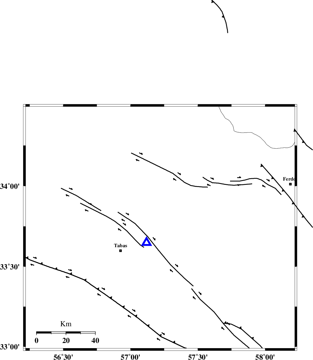
| Location | Lat:33.74 Lon: 57.22 |
| Region | Khorasan(center) Province, 32 km North-East of Tabas |
Nearest Cities |
|
| 9 km of Reqqeh, Khorasan(center) Province | |
| 16 km North West of Arsak, Khorasan(center) Province | |
| 24 km South West of Boshravieh, Khorasan(center) Province | |
| 31 km North East of Tabas, Yazd Province | |
| 35 km South West of Qaniabad, Khorasan(center) Province | |
| Depth | 14 km |
| Agency | |
Faults within 150 km: |
|
| ESFARDIAR_F (Length: 94 km) , Distance to epicenter: 14 km | |
| TABAS_F1 (Length: 91 km) , Distance to epicenter: 20 km | |
| TABAS_F2 (Length: 67 km) , Distance to epicenter: 27 km | |
| Number of Phases | 4 |
| RMS | 0 |
| Number of Stations | 3 |
| Error in Latitude | >9 km |
| Error in Longitude | 3.2 km |
| Error in Depth | 2.5 km |
Download waveform in seisan format
to download seisan software Click here
to access information about IIEES stations Click here
Amplitude | ||||||||
| UID | Agency | Station | Component | Amplitude | Period | Arrival Time | Proccessing Time | Signal Clip |
| 94785 | IIEES | TABS | N | 5959.4 | 0.2 | 2015-01-15 05:25:42 | 2015-01-15 02:22:00 | n |
| 94786 | IIEES | TABS | E | 3204.8 | 0.32 | 2015-01-15 05:25:42 | 2015-01-15 02:22:00 | n |
| 94787 | IIEES | YZKH | N | 26.9 | 0.4 | 2015-01-15 05:27:05 | 2015-01-15 02:22:00 | n |
| 94788 | IIEES | YZKH | E | 31.5 | 0.56 | 2015-01-15 05:27:06 | 2015-01-15 02:22:00 | n |
Phase | ||||||||||||
| Agency | Station | Component | Phase Type | Phase Quality | First Motion | Observed Arrival Time | Time Residual | Loc. Flag | Input Weight | Distance | Azimuth | |
| IIEES | TABS | Z | Pg | E | 2015-01-15 05:25:38 | 0 | y | 13.9 | 224 | |||
| IIEES | TABS | N | Sg | E | 2015-01-15 05:25:41 | 0 | y | 13.9 | 224 | |||
| IIEES | BSRN | Z | Pn | E | 2015-01-15 05:26:15 | 0 | y | 265 | 137 | |||
| IIEES | YZKH | Z | Pn | E | 2015-01-15 05:26:18 | 0 | y | 288 | 239 | |||