
Magnitude |
:2.5 |
| Date & Time (UTC) | 2015-01-13 02:27:58.6 |
| Date & Time (Local) | 1393/10/23 05:57:58.6 |
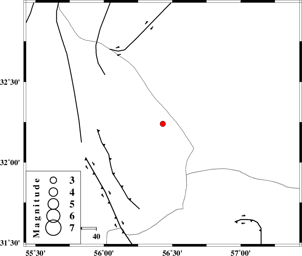
| Location | Lat:32.24 Lon: 56.43 |
| Region | Yazd Province, 114 km North-West of Ravar |
Nearest Cities |
|
| 56 km North East of Behabad, Yazd Province | |
| 65 km North East of Benestan, Yazd Province | |
| 66 km North East of Asfih, Yazd Province | |
| 82 km North East of Kushk, Yazd Province | |
| 92 km North East of Kuhbanan, Kerman Province | |
| Depth | 16 km |
| Agency | |
Faults within 150 km: |
|
| JAFARABAD_F (Length: 60 km) , Distance to epicenter: 43 km | |
| NAINI_F (Length: 342 km) , Distance to epicenter: 52 km | |
| CHESHMEH_ROSTAM_ (Length: 142 km) , Distance to epicenter: 57 km | |
| Number of Phases | 5 |
| RMS | 0.1 |
| Number of Stations | 4 |
| Error in Latitude | >3.6 km |
| Error in Longitude | 2.4 km |
| Error in Depth | 6.7 km |
Download waveform in seisan format
to download seisan software Click here
to access information about IIEES stations Click here
Amplitude | ||||||||
| UID | Agency | Station | Component | Amplitude | Period | Arrival Time | Proccessing Time | Signal Clip |
| 94771 | IIEES | KRBR | E | 27.2 | 0.32 | 2015-01-13 02:29:14 | 2015-01-13 03:43:00 | n |
Phase | ||||||||||||
| Agency | Station | Component | Phase Type | Phase Quality | First Motion | Observed Arrival Time | Time Residual | Loc. Flag | Input Weight | Distance | Azimuth | |
| IIEES | TABS | Z | Pn | E | 2015-01-13 02:28:26 | -0.2 | y | 169 | 22 | |||
| IIEES | TABS | N | Sg | E | 2015-01-13 02:28:47 | 0.09 | y | 169 | 22 | |||
| IIEES | YZKH | Z | Pn | E | 2015-01-13 02:28:28 | 0.2 | y | 174 | 276 | |||
| IIEES | YZKH | N | Sg | E | 2015-01-13 02:28:48 | -0.09 | y | 174 | 276 | |||
| IIEES | BSRN | Z | Pn | E | 2015-01-13 02:28:38 | 0 | y | 256 | 96 | |||