
Magnitude |
:2.5 |
| Date & Time (UTC) | 2015-01-11 02:42:24.3 |
| Date & Time (Local) | 1393/10/21 06:12:24.3 |
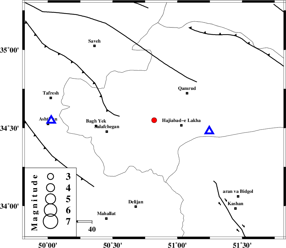
| Location | Lat:34.55 Lon: 50.82 |
| Region | Qom Province, 12 km Qom |
Nearest Cities |
|
| 12 km South of Qom, Qom Province | |
| 20 km North West of Hajiabad-e lakha, Qom Province | |
| 20 km North of Kahak, Qom Province | |
| 30 km South West of Qamrud, Qom Province | |
| 34 km North East of Salafchegan, Qom Province | |
| Depth | 14 km |
| Agency | |
Faults within 150 km: |
|
| INDES_F (Length: 98 km) , Distance to epicenter: 25 km | |
| KUSHK_E_NOSRAT_F (Length: 230 km) , Distance to epicenter: 38 km | |
| KASHAN_F (Length: 44 km) , Distance to epicenter: 60 km | |
| Number of Phases | 6 |
| RMS | 0.1 |
| Number of Stations | 6 |
| Error in Latitude | >2.1 km |
| Error in Longitude | 1.5 km |
| Error in Depth | 5.1 km |
Download waveform in seisan format
to download seisan software Click here
to access information about IIEES stations Click here
Amplitude | ||||||||
| UID | Agency | Station | Component | Amplitude | Period | Arrival Time | Proccessing Time | Signal Clip |
| 94750 | IIEES | THKV | N | 78.6 | 0.28 | 2015-01-11 02:43:11 | 2015-01-11 03:23:00 | n |
Phase | ||||||||||||
| Agency | Station | Component | Phase Type | Phase Quality | First Motion | Observed Arrival Time | Time Residual | Loc. Flag | Input Weight | Distance | Azimuth | |
| IIEES | GHVR | Z | Pg | E | 2015-01-11 02:42:31 | -0.11 | y | 40.2 | 101 | |||
| IIEES | GHVR | E | Sg | E | 2015-01-11 02:42:37 | 0.12 | y | 40.2 | 101 | |||
| IIEES | ASAO | Z | Pg | E | 2015-01-11 02:42:37 | 0.21 | y | 72.5 | 270 | |||
| IIEES | KHMZ | Z | Pg | E | 2015-01-11 02:42:44 | -0.16 | y | 119 | 221 | |||
| IIEES | CHTH | Z | Pg | E | 2015-01-11 02:42:49 | -0.08 | y | 153 | 11 | |||
| IIEES | NASN | Z | Pn | E | 2015-01-11 02:43:05 | 0.02 | y | 268 | 136 | |||