
Magnitude |
:1.8 |
| Date & Time (UTC) | 2015-01-05 08:07:11.5 |
| Date & Time (Local) | 1393/10/15 11:37:11.5 |
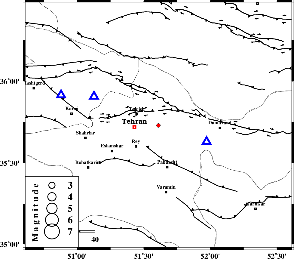
| Location | Lat:35.73 Lon: 51.61 |
| Region | Tehran Province, 17 km East of Tajrish |
Nearest Cities |
|
| 15 km West of Lavasan, Tehran Province | |
| 16 km South of Afjeh, Tehran Province | |
| 17 km East of Tajrish, Tehran Province | |
| 20 km North East of Tehran, Tehran Province | |
| 21 km North East of Rey, Tehran Province | |
| Depth | 14 km |
| Agency | |
Faults within 150 km: |
|
| N_TEHRAN_F4 (Length: 115 km) , Distance to epicenter: 10 km | |
| EYVANEKEY_F (Length: 74 km) , Distance to epicenter: 17 km | |
| MOSHA_F (Length: 234 km) , Distance to epicenter: 18 km | |
| Number of Phases | 6 |
| RMS | 0.1 |
| Number of Stations | 4 |
| Error in Latitude | >1.6 km |
| Error in Longitude | 1.5 km |
| Error in Depth | 4 km |
Download waveform in seisan format
to download seisan software Click here
to access information about IIEES stations Click here
Amplitude | ||||||||
| UID | Agency | Station | Component | Amplitude | Period | Arrival Time | Proccessing Time | Signal Clip |
| 94700 | IIEES | THKV | N | 48.9 | 0.49 | 2015-01-05 08:07:35 | 2015-01-05 10:51:00 | n |
| 94701 | IIEES | ASAO | E | 10.9 | 0.33 | 2015-01-05 08:08:08 | 2015-01-05 10:51:00 | n |
Phase | ||||||||||||
| Agency | Station | Component | Phase Type | Phase Quality | First Motion | Observed Arrival Time | Time Residual | Loc. Flag | Input Weight | Distance | Azimuth | |
| IIEES | DAMV | Z | Pg | E | 2015-01-05 08:07:18 | 0.05 | y | 34.6 | 109 | |||
| IIEES | CHTH | Z | Pg | E | 2015-01-05 08:07:20 | -0.11 | y | 47.8 | 294 | |||
| IIEES | CHTH | E | Sg | E | 2015-01-05 08:07:26 | 0.16 | y | 47.8 | 294 | |||
| IIEES | THKV | Z | Pg | E | 2015-01-05 08:07:23 | -0.11 | y | 69 | 287 | |||
| IIEES | ASAO | Z | Pn | E | 2015-01-05 08:07:43 | 0.02 | y | 195 | 228 | |||
| IIEES | ASAO | E | Sg | E | 2015-01-05 08:08:07 | 0 | y | 195 | 228 | |||