
Magnitude |
:2.1 |
| Date & Time (UTC) | 2014-12-30 02:00:58.4 |
| Date & Time (Local) | 1393/10/9 05:30:58.4 |
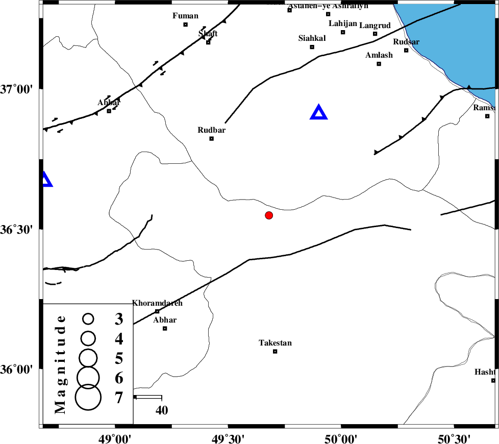
| Location | Lat:36.55 Lon: 49.68 |
| Region | Ghazvin Province, 54 km North of Takestan |
Nearest Cities |
|
| 13 km East of Kuhgir-e sofla, Ghazvin Province | |
| 17 km East of Loshan, Gilan Province | |
| 19 km South West of Jirhandeh, Gilan Province | |
| 20 km North of Kuhin, Ghazvin Province | |
| 25 km North of Aqababa, Ghazvin Province | |
| Depth | 35 km |
| Agency | |
Faults within 150 km: |
|
| ALAMUTRUD_F (Length: 140 km) , Distance to epicenter: 4 km | |
| N_QAZVIN_F (Length: 72 km) , Distance to epicenter: 16 km | |
| RUDBAR_F (Length: 93 km) , Distance to epicenter: 20 km | |
| Number of Phases | 4 |
| RMS | 0.1 |
| Number of Stations | 3 |
| Error in Latitude | >1.8 km |
| Error in Longitude | 0.9 km |
| Error in Depth | 0 km |
Download waveform in seisan format
to download seisan software Click here
to access information about IIEES stations Click here
Amplitude | ||||||||
| UID | Agency | Station | Component | Amplitude | Period | Arrival Time | Proccessing Time | Signal Clip |
| 94630 | IIEES | THKV | N | 34.3 | 0.08 | 2014-12-30 02:01:37 | 2014-12-30 02:47:00 | n |
Phase | ||||||||||||
| Agency | Station | Component | Phase Type | Phase Quality | First Motion | Observed Arrival Time | Time Residual | Loc. Flag | Input Weight | Distance | Azimuth | |
| IIEES | ZNJK | Z | Pg | E | 2014-12-30 02:01:14 | -0.06 | y | 90 | 279 | |||
| IIEES | THKV | Z | Pg | E | 2014-12-30 02:01:20 | 0.24 | y | 129 | 123 | |||
| IIEES | CHTH | E | Pn | E | 2014-12-30 02:01:22 | -0.03 | y | 148 | 118 | |||
| IIEES | CHTH | E | Sg | E | 2014-12-30 02:01:40 | -0.16 | y | 148 | 118 | |||