
Magnitude |
:3.6 |
| Date & Time (UTC) | 2014-12-29 10:26:31.5 |
| Date & Time (Local) | 1393/10/8 13:56:31.5 |
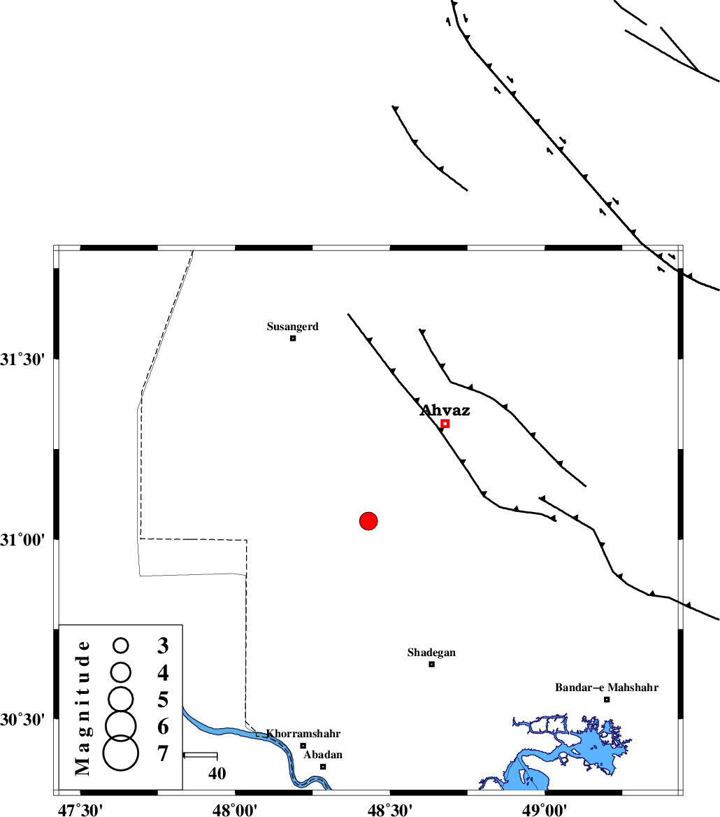
| Location | Lat:31.05 Lon: 48.43 |
| Region | Khoozestan Province, 39 km South-West of Ahvaz |
Nearest Cities |
|
| 18 km South West of Bahr, Khoozestan Province | |
| 20 km West of Abunangeh, Khoozestan Province | |
| 34 km North of Darkhovin, Khoozestan Province | |
| 38 km South West of Ahvaz, Khoozestan Province | |
| 45 km North West of Gharibeh, Khoozestan Province | |
| Depth | 14 km |
| Agency | |
Faults within 150 km: |
|
| AHVAZ_F (Length: 99 km) , Distance to epicenter: 41 km | |
| AGHAJARI_F (Length: 88 km) , Distance to epicenter: 78 km | |
| DEZFUL_EMBAYMENT (Length: 228 km) , Distance to epicenter: 121 km | |
| Number of Phases | 6 |
| RMS | 0.1 |
| Number of Stations | 7 |
| Error in Latitude | >9.5 km |
| Error in Longitude | 7.2 km |
| Error in Depth | 5.9 km |
Download waveform in seisan format
to download seisan software Click here
to access information about IIEES stations Click here
Amplitude | ||||||||
| UID | Agency | Station | Component | Amplitude | Period | Arrival Time | Proccessing Time | Signal Clip |
| 94620 | IIEES | AHRM | N | 163 | 0.48 | 2014-12-29 10:28:29 | 2014-12-29 12:28:00 | n |
| 94621 | IIEES | AHRM | E | 134.9 | 0.44 | 2014-12-29 10:28:39 | 2014-12-29 12:28:00 | n |
Phase | ||||||||||||
| Agency | Station | Component | Phase Type | Phase Quality | First Motion | Observed Arrival Time | Time Residual | Loc. Flag | Input Weight | Distance | Azimuth | |
| IIEES | SHGR | Z | Pg | E | 2014-12-29 10:26:52 | 0 | y | 123 | 16 | |||
| IIEES | KHMZ | Z | Pn | E | 2014-12-29 10:27:20 | 0.04 | y | 332 | 25 | |||
| IIEES | ASAO | Z | Pn | E | 2014-12-29 10:27:31 | 0.08 | y | 416 | 21 | |||
| IIEES | SNGE | Z | Pn | E | 2014-12-29 10:27:36 | -0.02 | y | 460 | 348 | |||
| IIEES | GHVR | Z | Pn | E | 2014-12-29 10:27:36 | -0.13 | y | 463 | 34 | |||
| IIEES | YZKH | Z | Pn | E | 2014-12-29 10:27:54 | 0.02 | y | 603 | 74 | |||