
Magnitude |
:2.8 |
| Date & Time (UTC) | 2014-12-16 18:15:34.9 |
| Date & Time (Local) | 1393/9/25 21:45:34.9 |
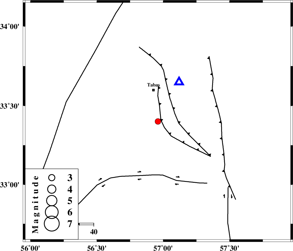
| Location | Lat:33.4 Lon: 56.96 |
| Region | Yazd Province, 23 km South of Tabas |
Nearest Cities |
|
| 6 km of Kerit, Yazd Province | |
| 18 km South of Oshtoqran, Yazd Province | |
| 22 km South of Tabas, Yazd Province | |
| 40 km South East of Jokhvah, Yazd Province | |
| 51 km North West of Dihuk, Yazd Province | |
| Depth | 18 km |
| Agency | |
Faults within 150 km: |
|
| TABAS_F2 (Length: 67 km) , Distance to epicenter: 2 km | |
| TABAS_F1 (Length: 91 km) , Distance to epicenter: 13 km | |
| CHESHMEH_ROSTAM_ (Length: 142 km) , Distance to epicenter: 38 km | |
| Number of Phases | 4 |
| RMS | 0.1 |
| Number of Stations | 3 |
| Error in Latitude | >3 km |
| Error in Longitude | 3.2 km |
| Error in Depth | 4.9 km |
Download waveform in seisan format
to download seisan software Click here
to access information about IIEES stations Click here
Amplitude | ||||||||
| UID | Agency | Station | Component | Amplitude | Period | Arrival Time | Proccessing Time | Signal Clip |
| 94528 | IIEES | YZKH | E | 62.7 | 0.32 | 2014-12-16 18:16:47 | 2014-12-16 06:59:00 | n |
Phase | ||||||||||||
| Agency | Station | Component | Phase Type | Phase Quality | First Motion | Observed Arrival Time | Time Residual | Loc. Flag | Input Weight | Distance | Azimuth | |
| IIEES | TABS | Z | Pg | E | 2014-12-16 18:15:41 | 0.02 | y | 31.7 | 27 | |||
| IIEES | YZKH | Z | Pn | E | 2014-12-16 18:16:13 | 0.03 | y | 248 | 244 | |||
| IIEES | BSRN | Z | Pn | E | 2014-12-16 18:16:14 | -0.1 | y | 258 | 127 | |||
| IIEES | BSRN | N | Sg | E | 2014-12-16 18:16:47 | 0.05 | y | 258 | 127 | |||