
Magnitude |
:2.3 |
| Date & Time (UTC) | 2014-12-11 19:19:39.3 |
| Date & Time (Local) | 1393/9/20 22:49:39.3 |
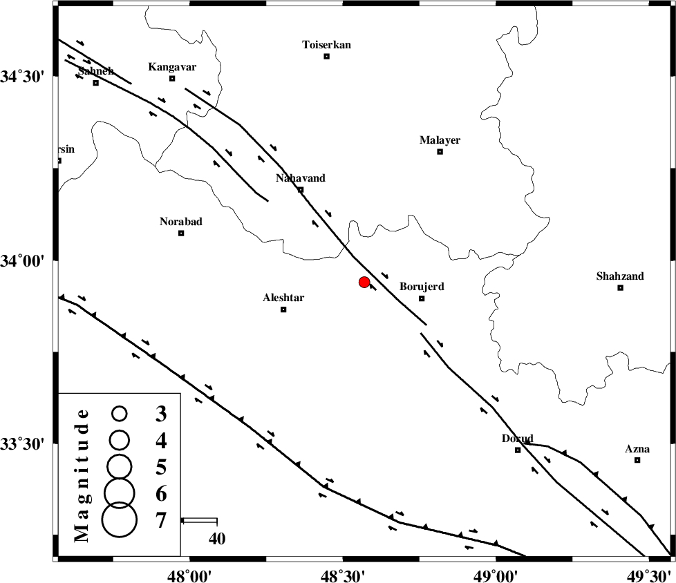
| Location | Lat:33.94 Lon: 48.57 |
| Region | Lorestan Province, 18 km West of Borujerd |
Nearest Cities |
|
| 9 km of Bon dizeh, Lorestan Province | |
| 11 km of Ashtarinan, Lorestan Province | |
| 13 km South of Jaefarabad, Lorestan Province | |
| 18 km South East of Babaqasem, Hamedan Province | |
| 18 km North West of Borujerd, Lorestan Province | |
| Depth | 34 km |
| Agency | |
Faults within 150 km: |
|
| NAHAVAND_F (Length: 102 km) , Distance to epicenter: 8 km | |
| DORUD (Length: 100 km) , Distance to epicenter: 23 km | |
| SAHANEH_F (Length: 77 km) , Distance to epicenter: 38 km | |
| Number of Phases | 5 |
| RMS | 0.1 |
| Number of Stations | 3 |
| Error in Latitude | >3.8 km |
| Error in Longitude | 2.4 km |
| Error in Depth | 5.1 km |
Download waveform in seisan format
to download seisan software Click here
to access information about IIEES stations Click here
Amplitude | ||||||||
| UID | Agency | Station | Component | Amplitude | Period | Arrival Time | Proccessing Time | Signal Clip |
| 94497 | IIEES | ASAO | E | 48.3 | 0.36 | 2014-12-11 19:20:27 | 2014-12-12 01:53:00 | n |
Phase | ||||||||||||
| Agency | Station | Component | Phase Type | Phase Quality | First Motion | Observed Arrival Time | Time Residual | Loc. Flag | Input Weight | Distance | Azimuth | |
| IIEES | KHMZ | Z | Pg | E | 2014-12-11 19:20:01 | -0.1 | y | 131 | 99 | |||
| IIEES | ASAO | Z | Pg | E | 2014-12-11 19:20:04 | 0.26 | y | 150 | 63 | |||
| IIEES | ASAO | N | Sg | E | 2014-12-11 19:20:22 | -0.11 | y | 150 | 63 | |||
| IIEES | SNGE | Z | Pn | E | 2014-12-11 19:20:06 | -0.02 | y | 170 | 319 | |||
| IIEES | SNGE | Z | Sg | E | 2014-12-11 19:20:27 | -0.02 | y | 170 | 319 | |||