
Magnitude |
:3.4 |
| Date & Time (UTC) | 2014-12-09 14:22:46.4 |
| Date & Time (Local) | 1393/9/18 17:52:46.4 |
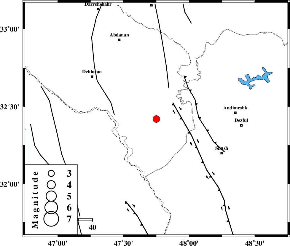
| Location | Lat:32.42 Lon: 47.75 |
| Region | Ilam Province, 57 km West of Andimeshk |
Nearest Cities |
|
| 39 km South East of Musian, Ilam Province | |
| 53 km North West of Shush, Khoozestan Province | |
| 55 km South West of Hoseinieh, Khoozestan Province | |
| 55 km South East of Dehloran, Ilam Province | |
| 56 km South East of Sarabbagh, Ilam Province | |
| Depth | 16 km |
| Agency | |
Faults within 150 km: |
|
| MFF6 (Length: 144 km) , Distance to epicenter: 33 km | |
| BALARUD_F_Z1 (Length: 87 km) , Distance to epicenter: 42 km | |
| DEZFUL_EMBAYMENT (Length: 228 km) , Distance to epicenter: 43 km | |
| Number of Phases | 5 |
| RMS | 0 |
| Number of Stations | 4 |
| Error in Latitude | >1.8 km |
| Error in Longitude | 4.4 km |
| Error in Depth | 5.1 km |
Download waveform in seisan format
to download seisan software Click here
to access information about IIEES stations Click here
Amplitude | ||||||||
| UID | Agency | Station | Component | Amplitude | Period | Arrival Time | Proccessing Time | Signal Clip |
| 94486 | IIEES | SHGR | E | 1121.6 | 0.56 | 2014-12-09 14:23:37 | 2014-12-09 02:42:00 | n |
Phase | ||||||||||||
| Agency | Station | Component | Phase Type | Phase Quality | First Motion | Observed Arrival Time | Time Residual | Loc. Flag | Input Weight | Distance | Azimuth | |
| IIEES | SHGR | Z | Pg | E | 2014-12-09 14:23:04 | 0 | y | 105 | 109 | |||
| IIEES | KHMZ | Z | Pn | E | 2014-12-09 14:23:25 | 0.06 | y | 254 | 54 | |||
| IIEES | SNGE | Z | Pn | E | 2014-12-09 14:23:31 | 0.01 | y | 299 | 353 | |||
| IIEES | ASAO | Z | Pn | E | 2014-12-09 14:23:33 | -0.08 | y | 317 | 41 | |||
| IIEES | ASAO | N | Sg | E | 2014-12-09 14:24:15 | 0 | y | 317 | 41 | |||