
Magnitude |
:3.5 |
| Date & Time (UTC) | 2014-12-08 22:34:08.7 |
| Date & Time (Local) | 1393/9/18 02:04:08.7 |
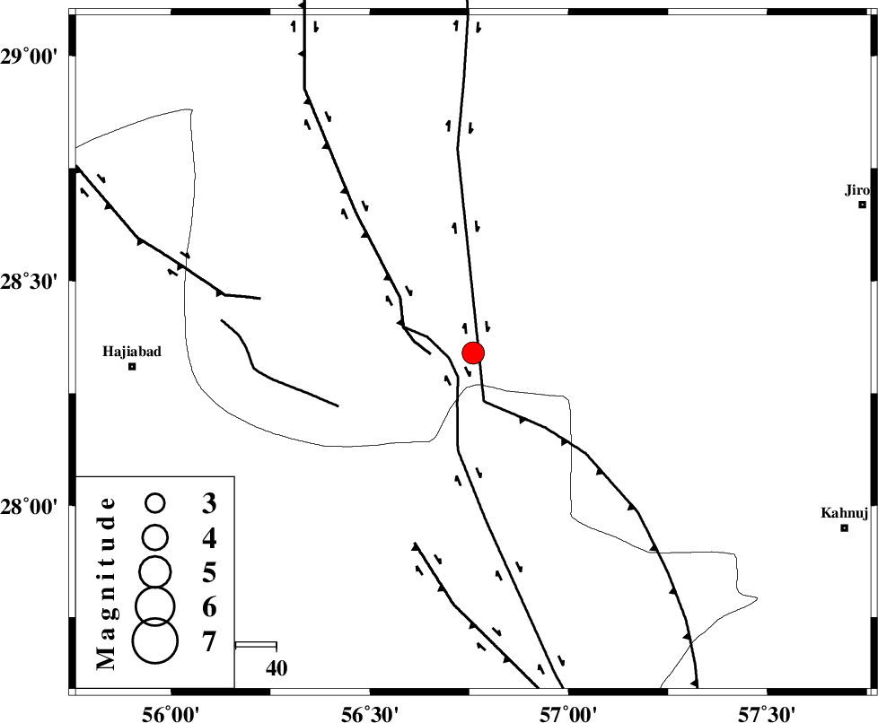
| Location | Lat:28.34 Lon: 56.76 |
| Region | Kerman Province, 84 km East of Hajiabad |
Nearest Cities |
|
| 11 km West of Sarkhan, Kerman Province | |
| 39 km South East of Shahmaran, Kerman Province | |
| 41 km East of Arzuieeh, Kerman Province | |
| 52 km South West of Dolatabad, Kerman Province | |
| 57 km North West of Hurpasefid, Kerman Province | |
| Depth | 14 km |
| Agency | |
Faults within 150 km: |
|
| MAIN_ZAGROS_R_F (Length: 1106 km) , Distance to epicenter: 29 km | |
| HZF2 (Length: 437 km) , Distance to epicenter: 70 km | |
| ZENDAN_MINAB_F_Z1 (Length: 183 km) , Distance to epicenter: 79 km | |
| Number of Phases | 7 |
| RMS | 0 |
| Number of Stations | 6 |
| Error in Latitude | >7.7 km |
| Error in Longitude | 4.6 km |
| Error in Depth | 9.6 km |
Download waveform in seisan format
to download seisan software Click here
to access information about IIEES stations Click here
Amplitude | ||||||||
| UID | Agency | Station | Component | Amplitude | Period | Arrival Time | Proccessing Time | Signal Clip |
| 94480 | IIEES | KRBR | E | 491.3 | 0.44 | 2014-12-08 22:35:10 | 2014-12-08 11:09:00 | n |
Phase | ||||||||||||
| Agency | Station | Component | Phase Type | Phase Quality | First Motion | Observed Arrival Time | Time Residual | Loc. Flag | Input Weight | Distance | Azimuth | |
| IIEES | KRBR | Z | Pn | E | 2014-12-08 22:34:39 | -0.04 | y | 182 | 360 | |||
| IIEES | ZHSF | Z | Pn | E | 2014-12-08 22:35:08 | -0.01 | y | 416 | 69 | |||
| IIEES | ZHSF | E | Sg | E | 2014-12-08 22:36:05 | 0 | y | 416 | 69 | |||
| IIEES | BSRN | Z | Pn | E | 2014-12-08 22:35:14 | 0.06 | y | 462 | 29 | |||
| IIEES | YZKH | Z | Pn | E | 2014-12-08 22:35:18 | -0.01 | y | 495 | 336 | |||
| IIEES | TABS | Z | Pn | E | 2014-12-08 22:35:29 | 0.04 | y | 590 | 3 | |||
| IIEES | SHRT | Z | Pn | E | 2014-12-08 22:35:40 | -0.01 | y | 678 | 29 | |||