
Magnitude |
:3.8 |
| Date & Time (UTC) | 2014-12-05 00:20:27.5 |
| Date & Time (Local) | 1393/9/14 03:50:27.5 |
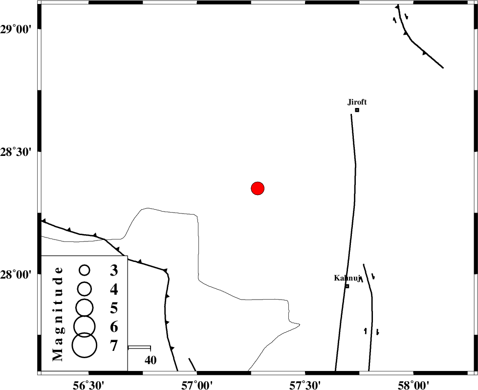
| Location | Lat:28.35 Lon: 57.28 |
| Region | Kerman Province, 57 km South-West of Jiroft |
Nearest Cities |
|
| 18 km North of Hurpasefid, Kerman Province | |
| 30 km North West of Bolock, Kerman Province | |
| 32 km North West of Mehrueye-e paeen, Kerman Province | |
| 32 km North of Faryab, Kerman Province | |
| 39 km North East of Sarkhan, Kerman Province | |
| Depth | 14 km |
| Agency | |
Faults within 150 km: |
|
| SABZEVARAN_F (Length: 190 km) , Distance to epicenter: 44 km | |
| MAIN_ZAGROS_R_F (Length: 1106 km) , Distance to epicenter: 56 km | |
| JIROFT_F (Length: 144 km) , Distance to epicenter: 59 km | |
| Number of Phases | 6 |
| RMS | 0.2 |
| Number of Stations | 5 |
| Error in Latitude | >2.4 km |
| Error in Longitude | 4.3 km |
| Error in Depth | 5.7 km |
Download waveform in seisan format
to download seisan software Click here
to access information about IIEES stations Click here
Amplitude | ||||||||
| UID | Agency | Station | Component | Amplitude | Period | Arrival Time | Proccessing Time | Signal Clip |
| 94448 | IIEES | BNDS | N | 1532.8 | 0.2 | 2014-12-05 00:21:13 | 2014-12-05 12:47:00 | n |
Phase | ||||||||||||
| Agency | Station | Component | Phase Type | Phase Quality | First Motion | Observed Arrival Time | Time Residual | Loc. Flag | Input Weight | Distance | Azimuth | |
| IIEES | BNDS | Z | Pg | E | 2014-12-05 00:20:52 | -0.16 | y | 151 | 226 | |||
| IIEES | BSRN | Z | Pn | E | 2014-12-05 00:21:29 | 0.06 | y | 439 | 23 | |||
| IIEES | BSRN | N | Sg | E | 2014-12-05 00:22:29 | -0.31 | y | 439 | 23 | |||
| IIEES | CHBR | Z | Pn | E | 2014-12-05 00:21:29 | 0.03 | y | 440 | 133 | |||
| IIEES | YZKH | Z | Pn | E | 2014-12-05 00:21:39 | 0.21 | y | 517 | 331 | |||
| IIEES | SHRT | Z | Pn | E | 2014-12-05 00:21:56 | 0.39 | y | 654 | 25 | |||