
Magnitude |
:3.1 |
| Date & Time (UTC) | 2014-12-04 10:18:53.6 |
| Date & Time (Local) | 1393/9/13 13:48:53.6 |
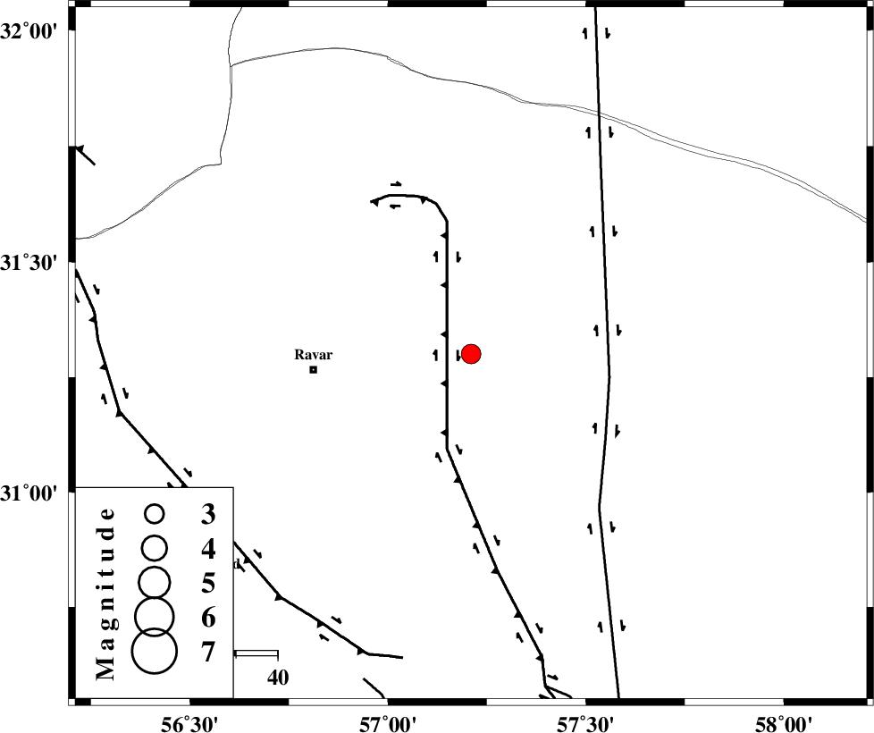
| Location | Lat:31.3 Lon: 57.21 |
| Region | Kerman Province, 38 km East of Ravar |
Nearest Cities |
|
| 38 km North East of Ravar, Kerman Province | |
| 39 km East of Dehali, Kerman Province | |
| 64 km North East of Hejdak, Kerman Province | |
| 64 km North East of Ahmadi, Kerman Province | |
| 65 km North East of Hatkan, Kerman Province | |
| Depth | 18 km |
| Agency | |
Faults within 150 km: |
|
| LAKARKUH_F (Length: 138 km) , Distance to epicenter: 24 km | |
| NAYBAND_F (Length: 258 km) , Distance to epicenter: 34 km | |
| KUHBANAN_F (Length: 189 km) , Distance to epicenter: 74 km | |
| Number of Phases | 5 |
| RMS | 0.1 |
| Number of Stations | 3 |
| Error in Latitude | >3.6 km |
| Error in Longitude | 2.3 km |
| Error in Depth | 6.5 km |
Download waveform in seisan format
to download seisan software Click here
to access information about IIEES stations Click here
Amplitude | ||||||||
| UID | Agency | Station | Component | Amplitude | Period | Arrival Time | Proccessing Time | Signal Clip |
| 94441 | IIEES | YZKH | E | 86.7 | 0.72 | 2014-12-04 10:20:15 | 2014-12-04 12:45:00 | n |
Phase | ||||||||||||
| Agency | Station | Component | Phase Type | Phase Quality | First Motion | Observed Arrival Time | Time Residual | Loc. Flag | Input Weight | Distance | Azimuth | |
| IIEES | BSRN | Z | Pn | E | 2014-12-04 10:19:25 | -0.09 | y | 197 | 67 | |||
| IIEES | BSRN | N | Sg | E | 2014-12-04 10:19:49 | 0.06 | y | 197 | 67 | |||
| IIEES | TABS | Z | Pn | E | 2014-12-04 10:19:33 | -0.01 | y | 261 | 358 | |||
| IIEES | TABS | N | Sg | E | 2014-12-04 10:20:07 | -0.01 | y | 261 | 358 | |||
| IIEES | YZKH | Z | Pn | E | 2014-12-04 10:19:35 | 0.05 | y | 276 | 297 | |||