
Magnitude |
:3 |
| Date & Time (UTC) | 2014-11-29 03:42:11.1 |
| Date & Time (Local) | 1393/9/8 07:12:11.1 |
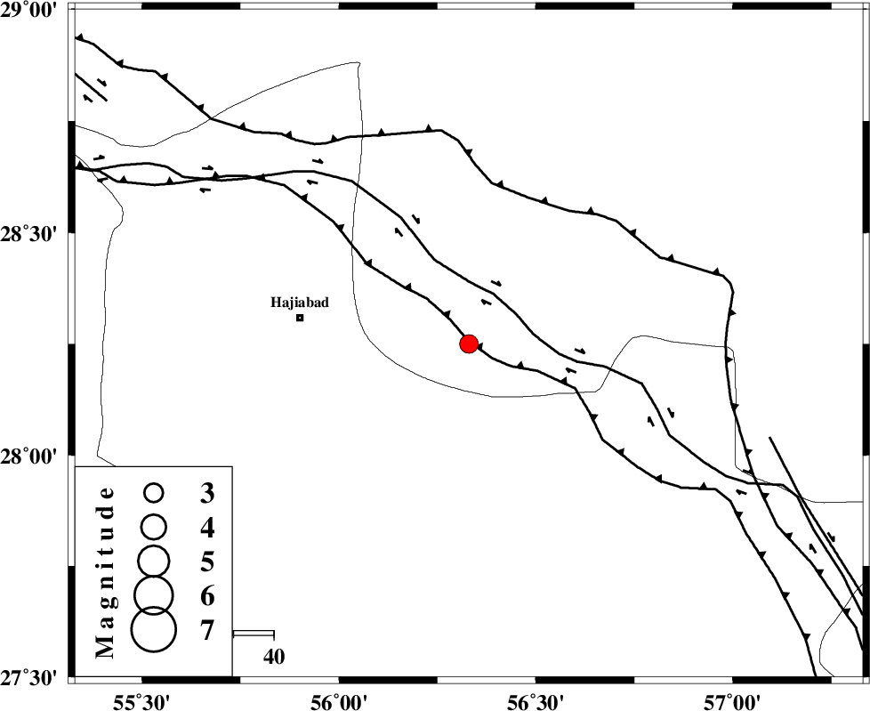
| Location | Lat:28.25 Lon: 56.33 |
| Region | Kerman Province, 42 km East of Hajiabad |
Nearest Cities |
|
| 21 km South of Arzuieeh, Kerman Province | |
| 24 km South of Shahmaran, Kerman Province | |
| 28 km North of Fareqan, Hormozgan Province | |
| 42 km East of Hajiabad, Hormozgan Province | |
| 55 km West of Sarkhan, Kerman Province | |
| Depth | 14 km |
| Agency | |
Faults within 150 km: |
|
| MAIN_ZAGROS_R_F (Length: 1106 km) , Distance to epicenter: 7 km | |
| HZF2 (Length: 437 km) , Distance to epicenter: 39 km | |
| ZENDAN_MINAB_F_Z1 (Length: 183 km) , Distance to epicenter: 91 km | |
| Number of Phases | 4 |
| RMS | 0 |
| Number of Stations | 3 |
| Error in Latitude | >2.6 km |
| Error in Longitude | 5.8 km |
| Error in Depth | 5.9 km |
Download waveform in seisan format
to download seisan software Click here
to access information about IIEES stations Click here
Amplitude | ||||||||
| UID | Agency | Station | Component | Amplitude | Period | Arrival Time | Proccessing Time | Signal Clip |
| 94402 | IIEES | BNDS | N | 520.9 | 0.29 | 2014-11-29 03:42:50 | 2014-11-29 04:28:00 | n |
Phase | ||||||||||||
| Agency | Station | Component | Phase Type | Phase Quality | First Motion | Observed Arrival Time | Time Residual | Loc. Flag | Input Weight | Distance | Azimuth | |
| IIEES | BNDS | Z | Pg | E | 2014-11-29 03:42:27 | 0 | y | 95.4 | 189 | |||
| IIEES | YZKH | Z | Pn | E | 2014-11-29 03:43:19 | -0.02 | y | 489 | 340 | |||
| IIEES | BSRN | N | Pn | E | 2014-11-29 03:43:20 | 0.02 | y | 492 | 33 | |||
| IIEES | BSRN | N | Sg | E | 2014-11-29 03:44:28 | -0.01 | y | 492 | 33 | |||