
Magnitude |
:3.8 |
| Date & Time (UTC) | 2014-11-15 22:29:24.0 |
| Date & Time (Local) | 1393/8/25 01:59:24.0 |
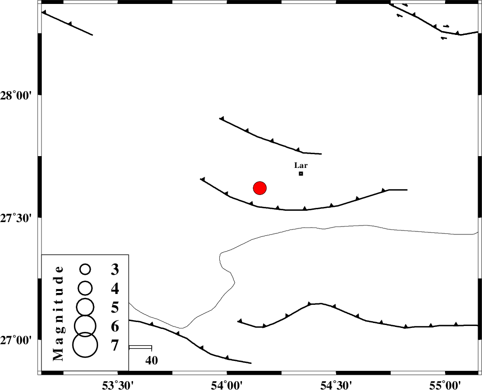
| Location | Lat:27.62 Lon: 54.15 |
| Region | Fars Province, 19 km West of Lar |
Nearest Cities |
|
| 4 km of Grash, Fars Province | |
| 18 km North East of Bagh, Fars Province | |
| 20 km West of Lar, Fars Province | |
| 21 km South East of Avaz, Fars Province | |
| 24 km West of Latifi, Fars Province | |
| Depth | 15 km |
| Agency | |
Faults within 150 km: |
|
| LAR_F (Length: 99 km) , Distance to epicenter: 9 km | |
| BERIZ_F (Length: 49 km) , Distance to epicenter: 23 km | |
| MFF1 (Length: 180 km) , Distance to epicenter: 58 km | |
| Number of Phases | 3 |
| RMS | 0 |
| Number of Stations | 3 |
| Error in Latitude | >4.8 km |
| Error in Longitude | 2.2 km |
| Error in Depth | 0 km |
Download waveform in seisan format
to download seisan software Click here
to access information about IIEES stations Click here
Amplitude | ||||||||
| UID | Agency | Station | Component | Amplitude | Period | Arrival Time | Proccessing Time | Signal Clip |
| 94283 | IIEES | BNDS | N | 749.8 | 0.4 | 2014-11-15 22:30:34 | 2014-11-15 11:58:00 | n |
| 94284 | IIEES | KRBR | N | 227.3 | 0.56 | 2014-11-15 22:31:17 | 2014-11-15 11:58:00 | n |
Phase | ||||||||||||
| Agency | Station | Component | Phase Type | Phase Quality | First Motion | Observed Arrival Time | Time Residual | Loc. Flag | Input Weight | Distance | Azimuth | |
| IIEES | GHIR | Z | Pg | E | 2014-11-15 22:29:46 | 0 | y | 136 | 303 | |||
| IIEES | BNDS | Z | Pg | E | 2014-11-15 22:29:57 | 0 | y | 201 | 97 | |||
| IIEES | KRBR | Z | Pn | E | 2014-11-15 22:30:17 | 0 | y | 365 | 44 | |||