
Magnitude |
:4.6 |
| Date & Time (UTC) | 2014-11-15 19:56:20.9 |
| Date & Time (Local) | 1393/8/24 23:26:20.9 |
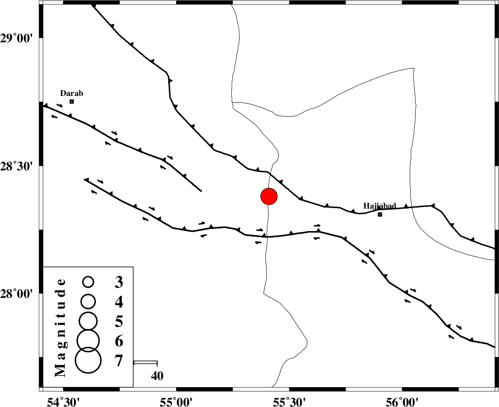
| Location | Lat:28.38 Lon: 55.41 |
| Region | Hormozgan Province, 49 km West of Hajiabad |
Nearest Cities |
|
| 22 km North East of Doborji, Fars Province | |
| 22 km South of Tal bargah, Fars Province | |
| 29 km North East of Fadami, Fars Province | |
| 34 km East of Rostaq, Fars Province | |
| 49 km North West of Hajiabad, Hormozgan Province | |
| Depth | 17 km |
| Agency | |
Faults within 150 km: |
|
| MAIN_ZAGROS_R_F (Length: 1106 km) , Distance to epicenter: 8 km | |
| HZF2 (Length: 437 km) , Distance to epicenter: 18 km | |
| HZF1 (Length: 102 km) , Distance to epicenter: 29 km | |
| Number of Phases | 5 |
| RMS | 0.1 |
| Number of Stations | 5 |
| Error in Latitude | >1.6 km |
| Error in Longitude | 4.5 km |
| Error in Depth | 7.5 km |
Download waveform in seisan format
to download seisan software Click here
to access information about IIEES stations Click here
Amplitude | ||||||||
| UID | Agency | Station | Component | Amplitude | Period | Arrival Time | Proccessing Time | Signal Clip |
| 94281 | IIEES | GHIR | E | 3800.6 | 0.56 | 2014-11-15 19:57:58 | 2014-11-15 08:23:00 | n |
| 94282 | IIEES | ASAO | E | 65.4 | 0.72 | 2014-11-15 19:59:47 | 2014-11-15 08:23:00 | n |
Phase | ||||||||||||
| Agency | Station | Component | Phase Type | Phase Quality | First Motion | Observed Arrival Time | Time Residual | Loc. Flag | Input Weight | Distance | Azimuth | |
| IIEES | BNDS | Z | Pg | E | 2014-11-15 19:56:43 | -0.01 | y | 132 | 145 | |||
| IIEES | KRBR | Z | Pg | E | 2014-11-15 19:56:57 | 0.08 | y | 221 | 36 | |||
| IIEES | KRBR | N | Sg | E | 2014-11-15 19:57:23 | -0.07 | y | 221 | 36 | |||
| IIEES | GHIR | Z | Pn | E | 2014-11-15 19:56:57 | -0.03 | y | 238 | 268 | |||
| IIEES | TABS | Z | Pn | E | 2014-11-15 19:57:43 | 0.05 | y | 607 | 15 | |||