
Magnitude |
:4.6 |
| Date & Time (UTC) | 2014-11-11 10:05:43.1 |
| Date & Time (Local) | 1393/8/20 13:35:43.1 |
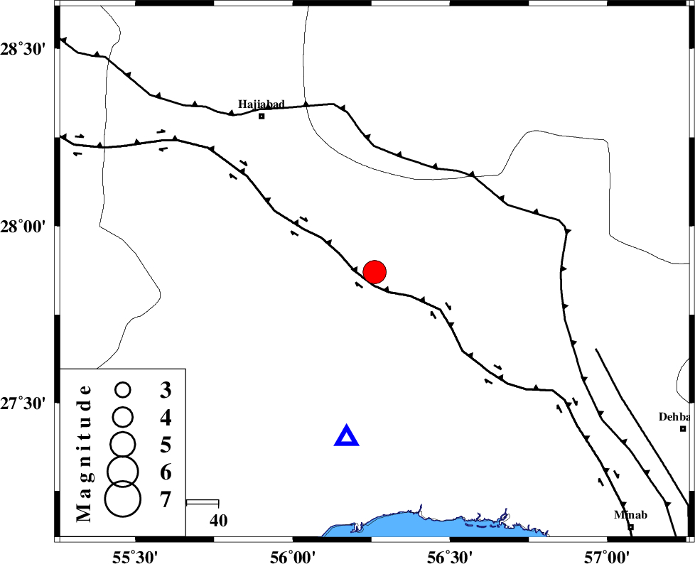
| Location | Lat:27.87 Lon: 56.26 |
| Region | Hormozgan Province, 76 km North of Bandar-e abbas |
Nearest Cities |
|
| 16 km South of Fareqan, Hormozgan Province | |
| 44 km North East of Fin, Hormozgan Province | |
| 60 km South East of Hajiabad, Hormozgan Province | |
| 64 km South West of Arzuieeh, Kerman Province | |
| 66 km South West of Shahmaran, Kerman Province | |
| Depth | 18 km |
| Agency | |
Faults within 150 km: |
|
| HZF2 (Length: 437 km) , Distance to epicenter: 4 km | |
| MAIN_ZAGROS_R_F (Length: 1106 km) , Distance to epicenter: 37 km | |
| ZENDAN_MINAB_F_Z1 (Length: 183 km) , Distance to epicenter: 73 km | |
| Number of Phases | 5 |
| RMS | 0.1 |
| Number of Stations | 5 |
| Error in Latitude | >2.6 km |
| Error in Longitude | 6.6 km |
| Error in Depth | 5.9 km |
Download waveform in seisan format
to download seisan software Click here
to access information about IIEES stations Click here
Amplitude | ||||||||
| UID | Agency | Station | Component | Amplitude | Period | Arrival Time | Proccessing Time | Signal Clip |
| 94254 | IIEES | GHIR | E | 2032.7 | 0.48 | 2014-11-11 10:07:20 | 2014-11-11 01:52:00 | n |
Phase | ||||||||||||
| Agency | Station | Component | Phase Type | Phase Quality | First Motion | Observed Arrival Time | Time Residual | Loc. Flag | Input Weight | Distance | Azimuth | |
| IIEES | BNDS | Z | Pg | E | 2014-11-11 10:05:52 | -0.01 | y | 52.3 | 189 | |||
| IIEES | KRBR | Z | Pg | E | 2014-11-11 10:06:22 | 0.02 | y | 240 | 12 | |||
| IIEES | GHIR | Z | Pn | E | 2014-11-11 10:06:30 | 0.05 | y | 325 | 279 | |||
| IIEES | YZKH | Z | Pn | E | 2014-11-11 10:06:55 | -0.17 | y | 527 | 343 | |||
| IIEES | TABS | Z | Pn | E | 2014-11-11 10:07:10 | 0.12 | y | 647 | 7 | |||