
Magnitude |
:3.8 |
| Date & Time (UTC) | 2014-11-08 22:13:04.2 |
| Date & Time (Local) | 1393/8/18 01:43:04.2 |
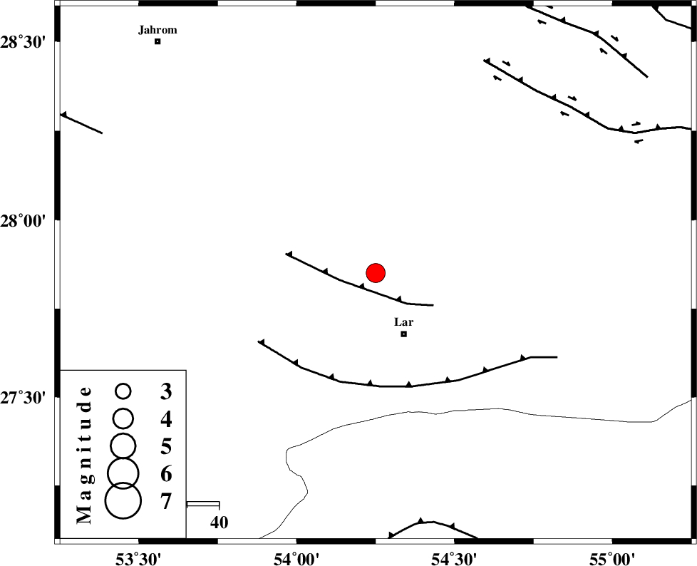
| Location | Lat:27.85 Lon: 54.25 |
| Region | Fars Province, 21 km North of Lar |
Nearest Cities |
|
| 17 km West of Dehkuyeh, Fars Province | |
| 21 km North of Lar, Fars Province | |
| 21 km North West of Latifi, Fars Province | |
| 24 km North of Grash, Fars Province | |
| 25 km North East of Avaz, Fars Province | |
| Depth | 14 km |
| Agency | |
Faults within 150 km: |
|
| BERIZ_F (Length: 49 km) , Distance to epicenter: 11 km | |
| LAR_F (Length: 99 km) , Distance to epicenter: 36 km | |
| HZF2 (Length: 437 km) , Distance to epicenter: 74 km | |
| Number of Phases | 4 |
| RMS | 0.1 |
| Number of Stations | 4 |
| Error in Latitude | >18.5 km |
| Error in Longitude | 7.4 km |
| Error in Depth | 9.5 km |
Download waveform in seisan format
to download seisan software Click here
to access information about IIEES stations Click here
Amplitude | ||||||||
| UID | Agency | Station | Component | Amplitude | Period | Arrival Time | Proccessing Time | Signal Clip |
| 94235 | IIEES | GHIR | E | 1211.5 | 0.6 | 2014-11-08 22:13:56 | 2014-11-08 10:36:00 | n |
| 94236 | IIEES | KHMZ | E | 22.6 | 0.44 | 2014-11-08 22:16:04 | 2014-11-08 10:36:00 | n |
Phase | ||||||||||||
| Agency | Station | Component | Phase Type | Phase Quality | First Motion | Observed Arrival Time | Time Residual | Loc. Flag | Input Weight | Distance | Azimuth | |
| IIEES | GHIR | Z | Pg | E | 2014-11-08 22:13:26 | -0.12 | y | 133 | 291 | |||
| IIEES | AHRM | Z | Pn | E | 2014-11-08 22:13:50 | 0.17 | y | 311 | 292 | |||
| IIEES | KRBR | Z | Pn | E | 2014-11-08 22:13:54 | -0.07 | y | 340 | 45 | |||
| IIEES | KRBR | N | Sg | E | 2014-11-08 22:14:39 | 0.03 | y | 340 | 45 | |||