
Magnitude |
:3.1 |
| Date & Time (UTC) | 2014-11-04 17:50:09.1 |
| Date & Time (Local) | 1393/8/13 21:20:09.1 |
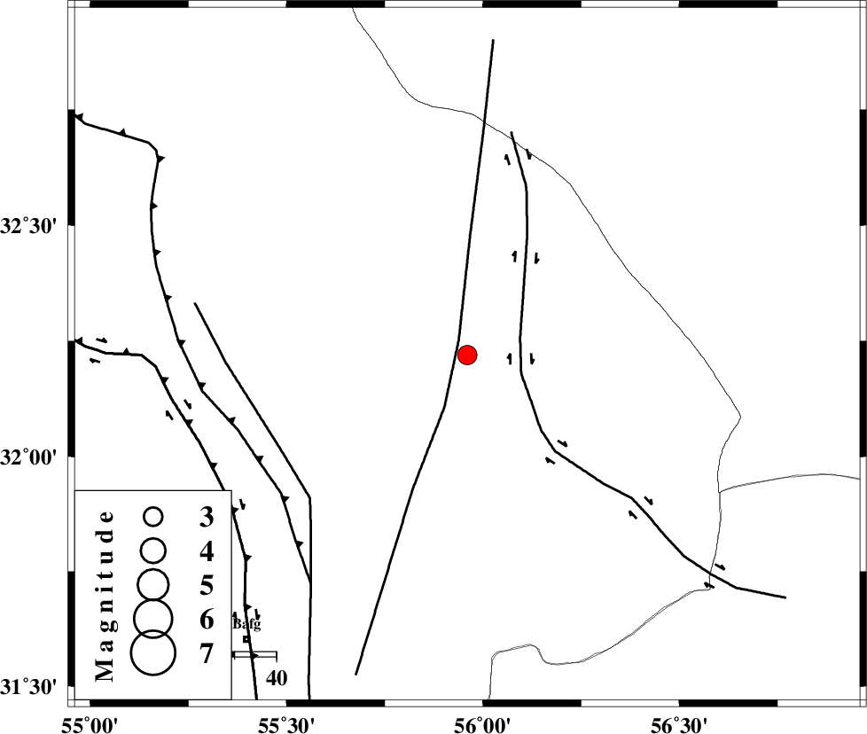
| Location | Lat:32.22 Lon: 55.96 |
| Region | Yazd Province, 87 km North-East of Bafq |
Nearest Cities |
|
| 39 km North of Behabad, Yazd Province | |
| 55 km North West of Benestan, Yazd Province | |
| 56 km North East of Kushk, Yazd Province | |
| 66 km North West of Asfih, Yazd Province | |
| 83 km North of Basab, Yazd Province | |
| Depth | 15 km |
| Agency | |
Faults within 150 km: |
|
| JAFARABAD_F (Length: 60 km) , Distance to epicenter: 2 km | |
| SARBALA_F (Length: 92 km) , Distance to epicenter: 14 km | |
| KUHBANAN_F (Length: 189 km) , Distance to epicenter: 23 km | |
| Number of Phases | 3 |
| RMS | 0 |
| Number of Stations | 3 |
| Error in Latitude | >1.7 km |
| Error in Longitude | 1.9 km |
| Error in Depth | 0 km |
Download waveform in seisan format
to download seisan software Click here
to access information about IIEES stations Click here
Amplitude | ||||||||
| UID | Agency | Station | Component | Amplitude | Period | Arrival Time | Proccessing Time | Signal Clip |
| 94196 | IIEES | KRBR | N | 106.7 | 0.28 | 2014-11-04 17:51:26 | 2014-11-04 06:21:00 | n |
Phase | ||||||||||||
| Agency | Station | Component | Phase Type | Phase Quality | First Motion | Observed Arrival Time | Time Residual | Loc. Flag | Input Weight | Distance | Azimuth | |
| IIEES | YZKH | Z | Pg | E | 2014-11-04 17:50:30 | 0 | y | 130 | 279 | |||
| IIEES | TABS | Z | Pg | E | 2014-11-04 17:50:40 | 0 | y | 192 | 34 | |||
| IIEES | KRBR | Z | Pn | E | 2014-11-04 17:50:49 | 0 | y | 260 | 163 | |||