
Magnitude |
:2.8 |
| Date & Time (UTC) | 2014-10-31 01:49:37.7 |
| Date & Time (Local) | 1393/8/9 05:19:37.7 |
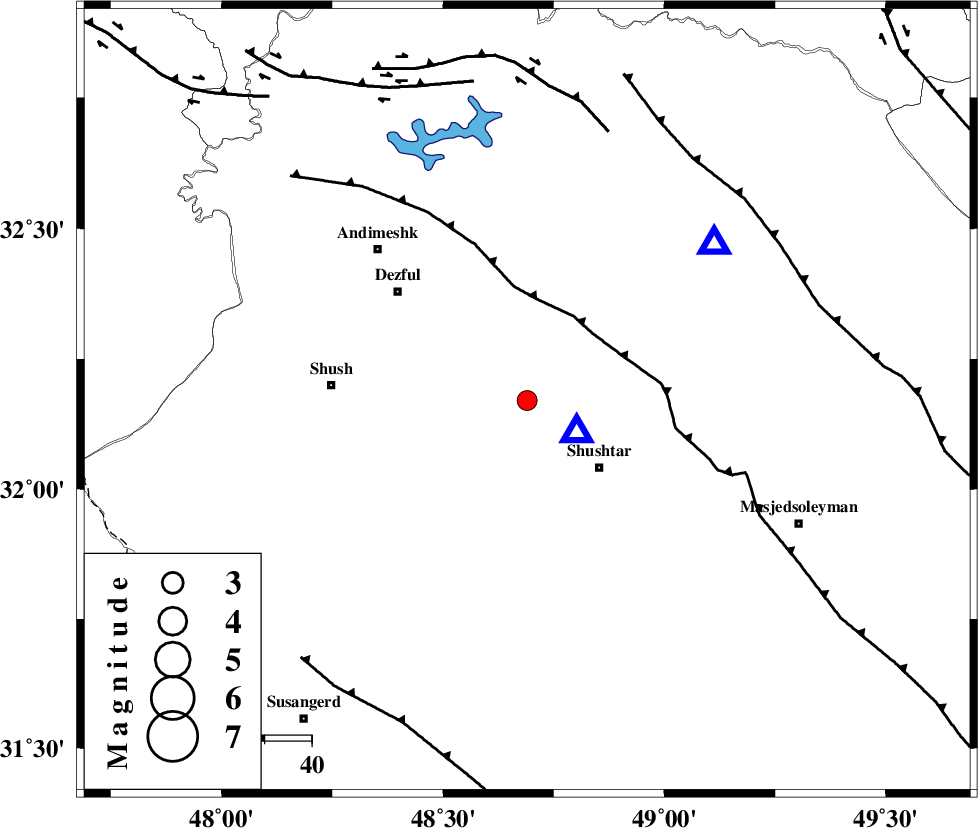
| Location | Lat:32.17 Lon: 48.69 |
| Region | Khoozestan Province, 21 km North-West of Shushtar |
Nearest Cities |
|
| 14 km West of Gatvand, Khoozestan Province | |
| 15 km West of Samaleh, Khoozestan Province | |
| 20 km North West of Sardarabad, Khoozestan Province | |
| 21 km North West of Shushtar, Khoozestan Province | |
| 25 km South of Mahur berenji, Khoozestan Province | |
| Depth | 18 km |
| Agency | |
Faults within 150 km: |
|
| DEZFUL_EMBAYMENT (Length: 228 km) , Distance to epicenter: 20 km | |
| BALARUD_F_Z2 (Length: 58 km) , Distance to epicenter: 60 km | |
| MFF2 (Length: 205 km) , Distance to epicenter: 63 km | |
| Number of Phases | 6 |
| RMS | 0.1 |
| Number of Stations | 5 |
| Error in Latitude | >2.1 km |
| Error in Longitude | 6.1 km |
| Error in Depth | 2.1 km |
Download waveform in seisan format
to download seisan software Click here
to access information about IIEES stations Click here
Amplitude | ||||||||
| UID | Agency | Station | Component | Amplitude | Period | Arrival Time | Proccessing Time | Signal Clip |
| 94179 | IIEES | SHGR | E | 2245 | 0.28 | 2014-10-31 01:49:56 | 2014-10-31 02:11:00 | n |
Phase | ||||||||||||
| Agency | Station | Component | Phase Type | Phase Quality | First Motion | Observed Arrival Time | Time Residual | Loc. Flag | Input Weight | Distance | Azimuth | |
| IIEES | SHGR | Z | Pg | E | 2014-10-31 01:49:41 | 0 | y | 12.6 | 120 | |||
| IIEES | KHMZ | Z | Pn | E | 2014-10-31 01:50:11 | -0.04 | y | 212 | 34 | |||
| IIEES | KHMZ | E | Sg | E | 2014-10-31 01:50:37 | -0.01 | y | 212 | 34 | |||
| IIEES | ASAO | Z | Pn | E | 2014-10-31 01:50:21 | -0.06 | y | 292 | 25 | |||
| IIEES | GHVR | Z | Pn | E | 2014-10-31 01:50:28 | 0.16 | y | 350 | 42 | |||
| IIEES | NASN | Z | Pn | E | 2014-10-31 01:50:34 | -0.06 | y | 394 | 79 | |||