
Magnitude |
:3.8 |
| Date & Time (UTC) | 2014-10-29 07:18:12.3 |
| Date & Time (Local) | 1393/8/7 10:48:12.3 |
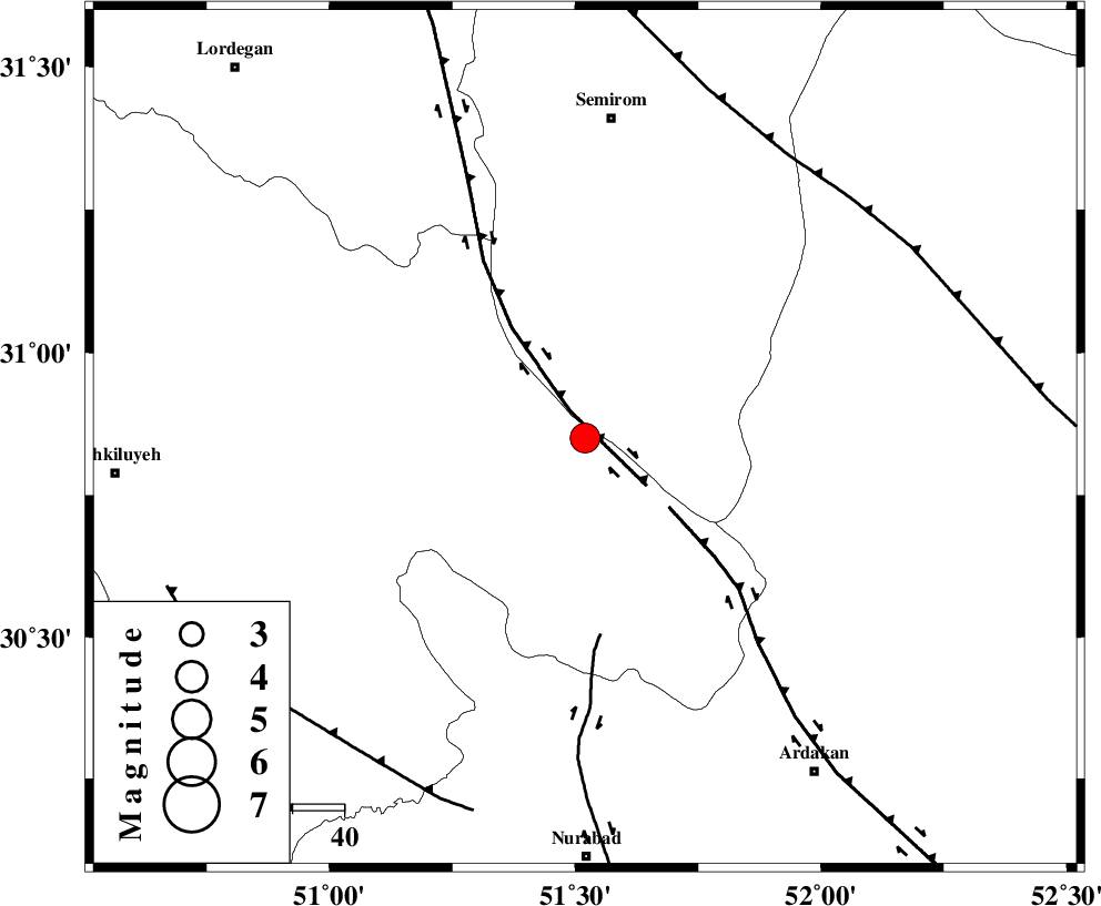
| Location | Lat:30.85 Lon: 51.52 |
| Region | Kohkiluieh va boyerahmad Province, 6 km Sisakht |
Nearest Cities |
|
| 6 km of Sisakht, Kohkiluieh va boyerahmad Province | |
| 11 km North East of Kerik, Kohkiluieh va boyerahmad Province | |
| 20 km North of Yasuj, Kohkiluieh va boyerahmad Province | |
| 22 km North East of Chitab, Kohkiluieh va boyerahmad Province | |
| 25 km South of Kameh, Esfahan Province | |
| Depth | 17 km |
| Agency | |
Faults within 150 km: |
|
| DENA_F (Length: 137 km) , Distance to epicenter: 6 km | |
| HZF3 (Length: 197 km) , Distance to epicenter: 21 km | |
| KAZERUN_F (Length: 96 km) , Distance to epicenter: 38 km | |
| Number of Phases | 8 |
| RMS | 0.2 |
| Number of Stations | 7 |
| Error in Latitude | >2.3 km |
| Error in Longitude | 5.3 km |
| Error in Depth | 9.8 km |
Download waveform in seisan format
to download seisan software Click here
to access information about IIEES stations Click here
Amplitude | ||||||||
| UID | Agency | Station | Component | Amplitude | Period | Arrival Time | Proccessing Time | Signal Clip |
| 94111 | IIEES | AHRM | N | 563 | 0.56 | 2014-10-29 07:19:27 | 2014-10-29 07:49:00 | n |
| 94112 | IIEES | GHIR | E | 351.9 | 0.6 | 2014-10-29 07:19:54 | 2014-10-29 07:49:00 | n |
Phase | ||||||||||||
| Agency | Station | Component | Phase Type | Phase Quality | First Motion | Observed Arrival Time | Time Residual | Loc. Flag | Input Weight | Distance | Azimuth | |
| IIEES | AHRM | Z | Pn | E | 2014-10-29 07:18:47 | 0.28 | y | 221 | 186 | |||
| IIEES | AHRM | N | Sg | E | 2014-10-29 07:19:14 | 0 | y | 221 | 186 | |||
| IIEES | NASN | Z | Pn | E | 2014-10-29 07:18:51 | 0.2 | y | 248 | 29 | |||
| IIEES | GHIR | Z | Pn | E | 2014-10-29 07:18:58 | -0.37 | y | 318 | 153 | |||
| IIEES | YZKH | Z | Pn | E | 2014-10-29 07:19:02 | 0.09 | y | 338 | 59 | |||
| IIEES | KHMZ | Z | Pn | E | 2014-10-29 07:19:03 | 0.15 | y | 352 | 336 | |||
| IIEES | GHVR | Z | Pn | E | 2014-10-29 07:19:09 | -0.27 | y | 403 | 356 | |||
| IIEES | ASAO | Z | Pn | E | 2014-10-29 07:19:13 | -0.2 | y | 433 | 342 | |||