
Magnitude |
:3.3 |
| Date & Time (UTC) | 2014-10-21 02:04:16.5 |
| Date & Time (Local) | 1393/7/29 05:34:16.5 |
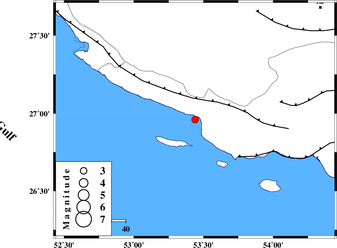
| Location | Lat:26.96 Lon: 53.44 |
| Region | Persian Gulf, 49 km South-East of Lamerd |
Nearest Cities |
|
| 34 km South West of Ashkenan, Fars Province | |
| 37 km South West of Ahl, Fars Province | |
| 49 km South East of Lamerd, Fars Province | |
| 52 km South of Beyram, Fars Province | |
| 70 km South of Fedagh, Fars Province | |
| Depth | 46 km |
| Agency | |
Faults within 150 km: |
|
| MFF3 (Length: 292 km) , Distance to epicenter: 16 km | |
| ZFF1 (Length: 165 km) , Distance to epicenter: 40 km | |
| MFF1 (Length: 180 km) , Distance to epicenter: 62 km | |
| Number of Phases | 5 |
| RMS | 0.1 |
| Number of Stations | 4 |
| Error in Latitude | >9.3 km |
| Error in Longitude | 6.6 km |
| Error in Depth | 6.7 km |
Download waveform in seisan format
to download seisan software Click here
to access information about IIEES stations Click here
Amplitude | ||||||||
| UID | Agency | Station | Component | Amplitude | Period | Arrival Time | Proccessing Time | Signal Clip |
| 94039 | IIEES | GHIR | E | 467.5 | 0.64 | 2014-10-21 02:05:05 | 2014-10-21 02:25:00 | n |
Phase | ||||||||||||
| Agency | Station | Component | Phase Type | Phase Quality | First Motion | Observed Arrival Time | Time Residual | Loc. Flag | Input Weight | Distance | Azimuth | |
| IIEES | GHIR | Z | Pn | E | 2014-10-21 02:04:40 | -0.03 | y | 154 | 343 | |||
| IIEES | GHIR | E | Sg | E | 2014-10-21 02:05:00 | 0 | y | 154 | 343 | |||
| IIEES | BNDS | Z | Pn | E | 2014-10-21 02:04:55 | 0.02 | y | 275 | 79 | |||
| IIEES | KRBR | Z | Pn | E | 2014-10-21 02:05:19 | -0.08 | y | 467 | 43 | |||
| IIEES | YZKH | Z | Pn | E | 2014-10-21 02:05:37 | 0.13 | y | 612 | 10 | |||