
Magnitude |
:2 |
| Date & Time (UTC) | 2014-10-17 13:17:39.9 |
| Date & Time (Local) | 1393/7/25 16:47:39.9 |
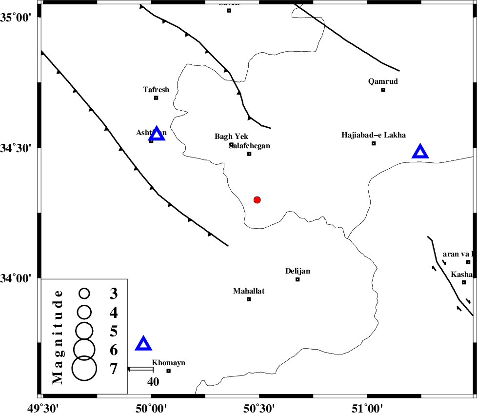
| Location | Lat:34.3 Lon: 50.49 |
| Region | Qom Province, 43 km North of Mahallat |
Nearest Cities |
|
| 20 km North of Dudhak, Markazi Province | |
| 20 km South of Salafchegan, Qom Province | |
| 26 km North of Khorheh, Markazi Province | |
| 26 km South East of Bagh yek, Qom Province | |
| 28 km East of Salehabad, Markazi Province | |
| Depth | 15 km |
| Agency | |
Faults within 150 km: |
|
| TAFRESH_F (Length: 117 km) , Distance to epicenter: 23 km | |
| INDES_F (Length: 98 km) , Distance to epicenter: 31 km | |
| KASHAN_F (Length: 44 km) , Distance to epicenter: 74 km | |
| Number of Phases | 3 |
| RMS | 0 |
| Number of Stations | 4 |
| Error in Latitude | >1.9 km |
| Error in Longitude | 1.3 km |
| Error in Depth | 0 km |
Download waveform in seisan format
to download seisan software Click here
to access information about IIEES stations Click here
Amplitude | ||||||||
| UID | Agency | Station | Component | Amplitude | Period | Arrival Time | Proccessing Time | Signal Clip |
| 93968 | IIEES | GHVR | E | 46.9 | 0.28 | 2014-10-17 13:18:02 | 2014-10-17 02:43:00 | n |
| 93969 | IIEES | DAMV | E | 19.4 | 0.64 | 2014-10-17 13:18:39 | 2014-10-17 02:43:00 | n |
Phase | ||||||||||||
| Agency | Station | Component | Phase Type | Phase Quality | First Motion | Observed Arrival Time | Time Residual | Loc. Flag | Input Weight | Distance | Azimuth | |
| IIEES | ASAO | Z | Pg | E | 2014-10-17 13:17:49 | 0 | y | 51 | 303 | |||
| IIEES | GHVR | E | Sg | E | 2014-10-17 13:18:01 | 0 | y | 71.9 | 74 | |||
| IIEES | KHMZ | Z | Pg | E | 2014-10-17 13:17:53 | 0 | y | 79.2 | 218 | |||