
Magnitude |
:2 |
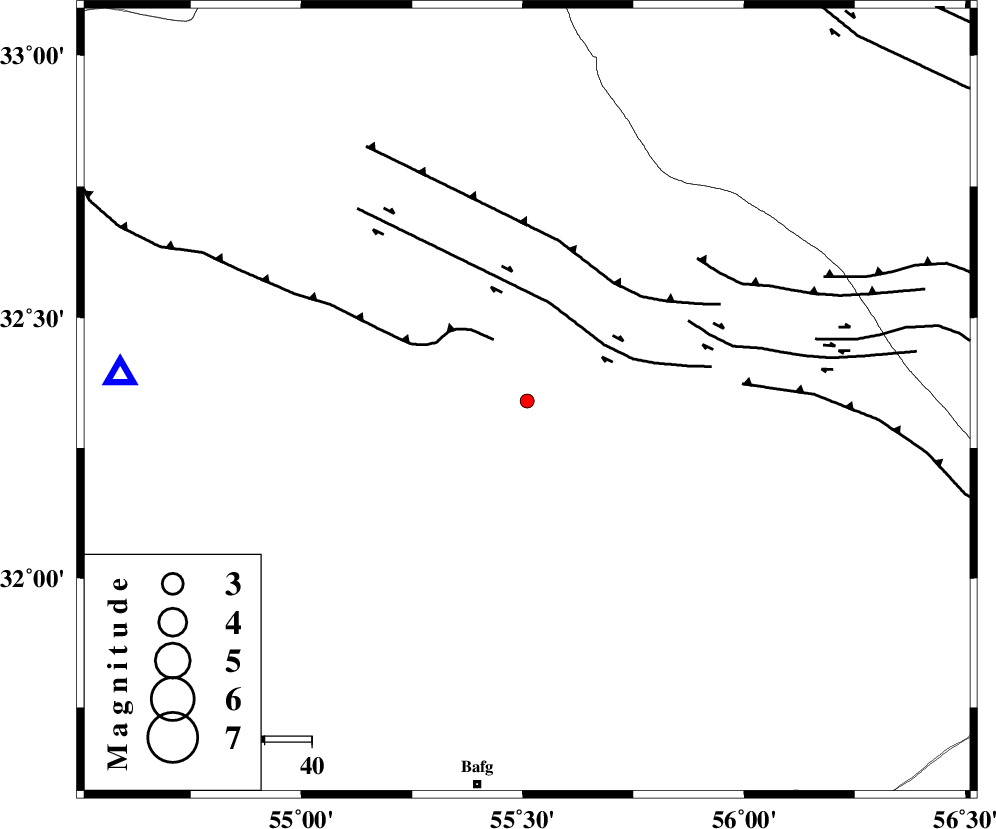
| Date & Time (UTC) | 2014-10-14 09:39:07.2 |
| Date & Time (Local) | 1393/7/22 13:09:07.2 |
| Location | Lat:32.34 Lon: 55.51 |
| Region | Yazd Province, 83 km North-East of Bafq |
Nearest Cities |
|
| 71 km North West of Behabad, Yazd Province | |
| 72 km North West of Kushk, Yazd Province | |
| 76 km South of Robat-e posht-e badam, Yazd Province | |
| 80 km North East of Kharaneq, Yazd Province | |
| 80 km North of Mobarake, Yazd Province | |
| Depth | 14 km |
| Agency | |
Faults within 150 km: |
|
| POSHT_E_BADAM_F (Length: 128 km) , Distance to epicenter: 24 km | |
| SARBALA_F (Length: 92 km) , Distance to epicenter: 28 km | |
| JAFARABAD_F (Length: 60 km) , Distance to epicenter: 44 km | |
| Number of Phases | 6 |
| RMS | 0 |
| Number of Stations | 4 |
| Error in Latitude | >1.8 km |
| Error in Longitude | 1.9 km |
| Error in Depth | 4.8 km |
Download waveform in seisan format
to download seisan software Click here
to access information about IIEES stations Click here
Amplitude | ||||||||
| UID | Agency | Station | Component | Amplitude | Period | Arrival Time | Proccessing Time | Signal Clip |
| 93883 | IIEES | TABS | N | 9.7 | 0.65 | 2014-10-14 09:40:22 | 2014-10-14 10:49:00 | n |
| 93884 | IIEES | KRBR | N | 9.9 | 0.49 | 2014-10-14 09:40:35 | 2014-10-14 10:49:00 | n |
Phase | ||||||||||||
| Agency | Station | Component | Phase Type | Phase Quality | First Motion | Observed Arrival Time | Time Residual | Loc. Flag | Input Weight | Distance | Azimuth | |
| IIEES | YZKH | Z | Pg | E | 2014-10-14 09:39:22 | 0.04 | y | 86.2 | 274 | |||
| IIEES | YZKH | E | Sg | E | 2014-10-14 09:39:33 | -0.04 | y | 86.2 | 274 | |||
| IIEES | TABS | Z | Pn | E | 2014-10-14 09:39:40 | 0 | y | 209 | 46 | |||
| IIEES | KRBR | Z | Pn | E | 2014-10-14 09:39:50 | 0.07 | y | 288 | 155 | |||
| IIEES | KRBR | N | Sg | E | 2014-10-14 09:40:28 | -0.03 | y | 288 | 155 | |||
| IIEES | BSRN | Z | Pn | E | 2014-10-14 09:39:57 | -0.05 | y | 344 | 96 | |||