
Magnitude |
:3 |
| Date & Time (UTC) | 2014-10-06 01:48:20.6 |
| Date & Time (Local) | 1393/7/14 05:18:20.6 |
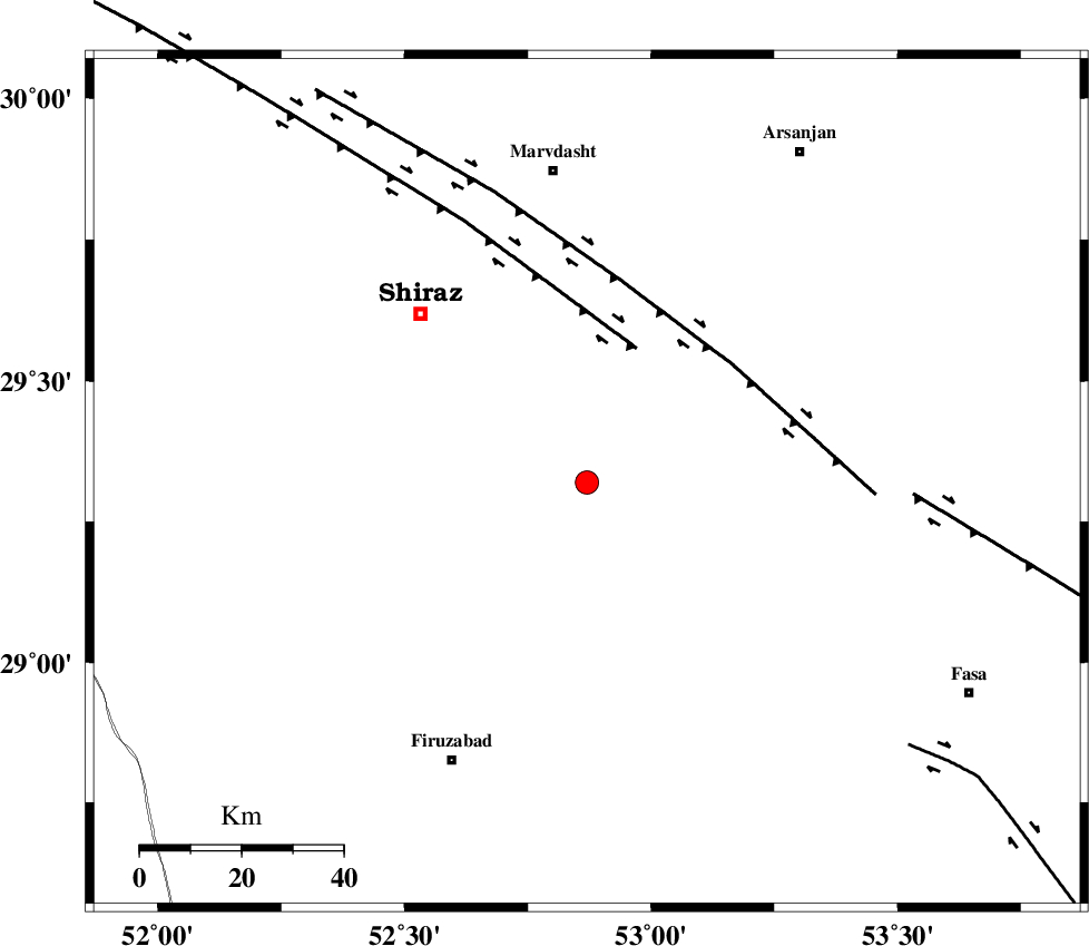
| Location | Lat:29.32 Lon: 52.87 |
| Region | Fars Province, 62 km South of Marvdasht |
Nearest Cities |
|
| 6 km of Maharlu, Fars Province | |
| 12 km North of Kuhanjan, Fars Province | |
| 13 km North of Akbarabad, Fars Province | |
| 18 km North East of Tasuj, Fars Province | |
| 19 km North East of Kavar, Fars Province | |
| Depth | 14 km |
| Agency | |
Faults within 150 km: |
|
| SABZ_PUSHAN_F_Z1 (Length: 69 km) , Distance to epicenter: 23 km | |
| HZF3 (Length: 197 km) , Distance to epicenter: 31 km | |
| SABZ_PUSHAN_F_Z3 (Length: 37 km) , Distance to epicenter: 34 km | |
| Number of Phases | 6 |
| RMS | 0.1 |
| Number of Stations | 4 |
| Error in Latitude | >0.9 km |
| Error in Longitude | 1.9 km |
| Error in Depth | 3.4 km |
Download waveform in seisan format
to download seisan software Click here
to access information about IIEES stations Click here
Amplitude | ||||||||
| UID | Agency | Station | Component | Amplitude | Period | Arrival Time | Proccessing Time | Signal Clip |
| 93776 | IIEES | KRBR | E | 29.1 | 0.56 | 2014-10-06 01:50:20 | 2014-10-06 02:37:00 | n |
Phase | ||||||||||||
| Agency | Station | Component | Phase Type | Phase Quality | First Motion | Observed Arrival Time | Time Residual | Loc. Flag | Input Weight | Distance | Azimuth | |
| IIEES | GHIR | Z | Pg | E | 2014-10-06 01:48:40 | 0.01 | y | 115 | 174 | |||
| IIEES | GHIR | E | Sg | E | 2014-10-06 01:48:54 | -0.04 | y | 115 | 174 | |||
| IIEES | AHRM | Z | Pg | E | 2014-10-06 01:48:47 | 0.02 | y | 162 | 252 | |||
| IIEES | YZKH | Z | Pn | E | 2014-10-06 01:49:15 | 0.04 | y | 378 | 25 | |||
| IIEES | YZKH | N | Sg | E | 2014-10-06 01:50:06 | -0.1 | y | 378 | 25 | |||
| IIEES | KRBR | Z | P | E | 2014-10-06 01:49:16 | 0.07 | y | 383 | 78 | |||