
Magnitude |
:1.8 |
| Date & Time (UTC) | 2014-10-05 09:43:43.9 |
| Date & Time (Local) | 1393/7/13 13:13:43.9 |
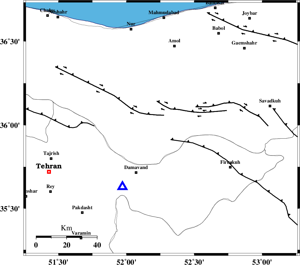
| Location | Lat:35.98 Lon: 52.26 |
| Region | Mazandaran Province, 33 km North-East of Damavand |
Nearest Cities |
|
| 3 km of Baijan, Mazandaran Province | |
| 10 km North of Gaznak, Mazandaran Province | |
| 14 km North of Rineh, Mazandaran Province | |
| 31 km South East of Pil, Mazandaran Province | |
| 31 km North West of Arjomand, Tehran Province | |
| Depth | 6 km |
| Agency | |
Faults within 150 km: |
|
| MOSHA_F (Length: 234 km) , Distance to epicenter: 29 km | |
| N_ALBORZ_F (Length: 360 km) , Distance to epicenter: 33 km | |
| KANDOVAN_F (Length: 90 km) , Distance to epicenter: 41 km | |
| Number of Phases | 7 |
| RMS | 0.4 |
| Number of Stations | 4 |
| Error in Latitude | >6.1 km |
| Error in Longitude | 9.4 km |
| Error in Depth | 13.2 km |
Download waveform in seisan format
to download seisan software Click here
to access information about IIEES stations Click here
Amplitude | ||||||||
| UID | Agency | Station | Component | Amplitude | Period | Arrival Time | Proccessing Time | Signal Clip |
| 93773 | IIEES | THKV | N | 26.9 | 0.42 | 2014-10-05 09:44:23 | 2014-10-05 11:52:00 | n |
| 93774 | IIEES | GHVR | N | 7.4 | 0.47 | 2014-10-05 09:44:43 | 2014-10-05 11:52:00 | n |
Phase | ||||||||||||
| Agency | Station | Component | Phase Type | Phase Quality | First Motion | Observed Arrival Time | Time Residual | Loc. Flag | Input Weight | Distance | Azimuth | |
| IIEES | DAMV | Z | Pg | E | 2014-10-05 09:43:52 | -0.38 | y | 46.2 | 214 | |||
| IIEES | CHTH | Z | Pg | E | 2014-10-05 09:44:01 | -0.14 | y | 102 | 266 | |||
| IIEES | CHTH | N | Sg | E | 2014-10-05 09:44:14 | -0.24 | y | 102 | 266 | |||
| IIEES | THKV | Z | Pg | E | 2014-10-05 09:44:05 | -0.47 | y | 125 | 267 | |||
| IIEES | THKV | N | Sg | E | 2014-10-05 09:44:22 | 0.62 | y | 125 | 267 | |||
| IIEES | GHVR | Z | Pn | E | 2014-10-05 09:44:16 | 0.7 | y | 190 | 209 | |||
| IIEES | GHVR | N | Sg | E | 2014-10-05 09:44:40 | -0.08 | y | 190 | 209 | |||