
Magnitude |
:3.7 |
| Date & Time (UTC) | 2014-10-04 06:28:37.1 |
| Date & Time (Local) | 1393/7/12 09:58:37.1 |
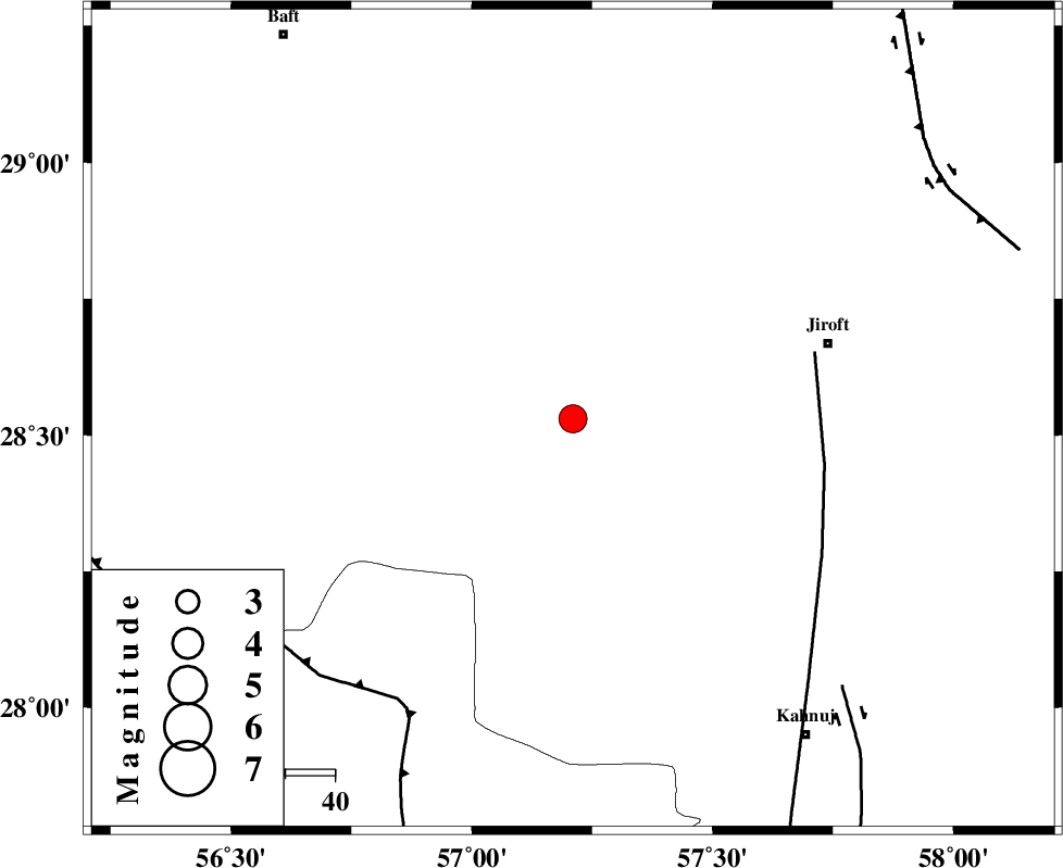
| Location | Lat:28.53 Lon: 57.21 |
| Region | Kerman Province, 54 km South-West of Jiroft |
Nearest Cities |
|
| 24 km South East of Dolatabad, Kerman Province | |
| 39 km North West of Hurpasefid, Kerman Province | |
| 39 km North East of Sarkhan, Kerman Province | |
| 48 km North West of Bolock, Kerman Province | |
| 48 km West of Khatunabad-e zangian, Kerman Province | |
| Depth | 14 km |
| Agency | |
Faults within 150 km: |
|
| SABZEVARAN_F (Length: 190 km) , Distance to epicenter: 51 km | |
| MAIN_ZAGROS_R_F (Length: 1106 km) , Distance to epicenter: 67 km | |
| JIROFT_F (Length: 144 km) , Distance to epicenter: 77 km | |
| Number of Phases | 6 |
| RMS | 0.1 |
| Number of Stations | 5 |
| Error in Latitude | >3.2 km |
| Error in Longitude | 8.7 km |
| Error in Depth | 4.4 km |
Download waveform in seisan format
to download seisan software Click here
to access information about IIEES stations Click here
Amplitude | ||||||||
| UID | Agency | Station | Component | Amplitude | Period | Arrival Time | Proccessing Time | Signal Clip |
| 93758 | IIEES | BNDS | E | 1046.1 | 0.38 | 2014-10-04 06:29:26 | 2014-10-04 06:51:00 | n |
Phase | ||||||||||||
| Agency | Station | Component | Phase Type | Phase Quality | First Motion | Observed Arrival Time | Time Residual | Loc. Flag | Input Weight | Distance | Azimuth | |
| IIEES | BNDS | Z | Pg | E | 2014-10-04 06:29:03 | -0.12 | y | 162 | 219 | |||
| IIEES | BNDS | E | Sg | E | 2014-10-04 06:29:23 | 0.04 | y | 162 | 219 | |||
| IIEES | KRBR | Z | Pg | E | 2014-10-04 06:29:04 | -0.12 | y | 167 | 345 | |||
| IIEES | GHIR | Z | Pn | E | 2014-10-04 06:29:36 | 0.15 | y | 415 | 267 | |||
| IIEES | YZKH | Z | Pn | E | 2014-10-04 06:29:46 | -0.09 | y | 496 | 330 | |||
| IIEES | TABS | Z | Pn | E | 2014-10-04 06:29:55 | 0.25 | y | 568 | 359 | |||