
Magnitude |
:2.7 |
| Date & Time (UTC) | 2014-09-28 03:33:43.5 |
| Date & Time (Local) | 1393/7/6 07:03:43.5 |
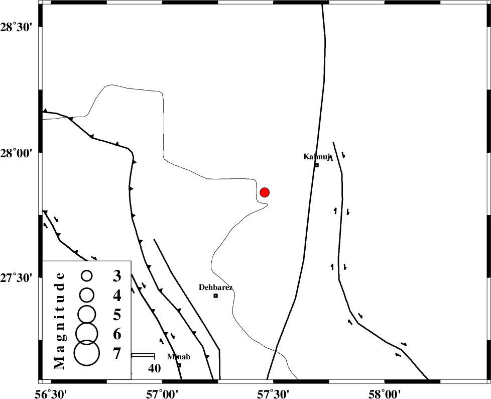
| Location | Lat:27.84 Lon: 57.46 |
| Region | Kerman Province, 27 km South-West of Kahnuj |
Nearest Cities |
|
| 18 km North East of Fariab, Hormozgan Province | |
| 26 km North East of Ziaratali, Hormozgan Province | |
| 26 km South West of Kahnuj, Kerman Province | |
| 27 km North of Bejogan, Kerman Province | |
| 28 km South of Mehrueye-e paeen, Kerman Province | |
| Depth | 14 km |
| Agency | |
Faults within 150 km: |
|
| SABZEVARAN_F (Length: 190 km) , Distance to epicenter: 20 km | |
| JIROFT_F (Length: 144 km) , Distance to epicenter: 35 km | |
| ZENDAN_MINAB_F_Z1 (Length: 183 km) , Distance to epicenter: 53 km | |
| Number of Phases | 5 |
| RMS | 0.2 |
| Number of Stations | 4 |
| Error in Latitude | >2.4 km |
| Error in Longitude | 5.8 km |
| Error in Depth | 8.9 km |
Download waveform in seisan format
to download seisan software Click here
to access information about IIEES stations Click here
Amplitude | ||||||||
| UID | Agency | Station | Component | Amplitude | Period | Arrival Time | Proccessing Time | Signal Clip |
| 93719 | IIEES | KRBR | N | 41.7 | 0.5 | 2014-09-28 03:34:56 | 2014-09-29 04:22:00 | n |
Phase | ||||||||||||
| Agency | Station | Component | Phase Type | Phase Quality | First Motion | Observed Arrival Time | Time Residual | Loc. Flag | Input Weight | Distance | Azimuth | |
| IIEES | BNDS | Z | Pg | E | 2014-09-28 03:34:06 | -0.04 | y | 136 | 249 | |||
| IIEES | KRBR | Z | Pn | E | 2014-09-28 03:34:22 | 0.29 | y | 247 | 344 | |||
| IIEES | KRBR | N | Sg | E | 2014-09-28 03:34:53 | -0.05 | y | 247 | 344 | |||
| IIEES | ZHSF | Z | Pn | E | 2014-09-28 03:34:38 | -0.01 | y | 379 | 58 | |||
| IIEES | BSRN | Z | Pn | E | 2014-09-28 03:34:51 | -0.28 | y | 485 | 19 | |||