
Magnitude |
:3 |
| Date & Time (UTC) | 2014-09-24 05:47:23.3 |
| Date & Time (Local) | 1393/7/2 09:17:23.3 |
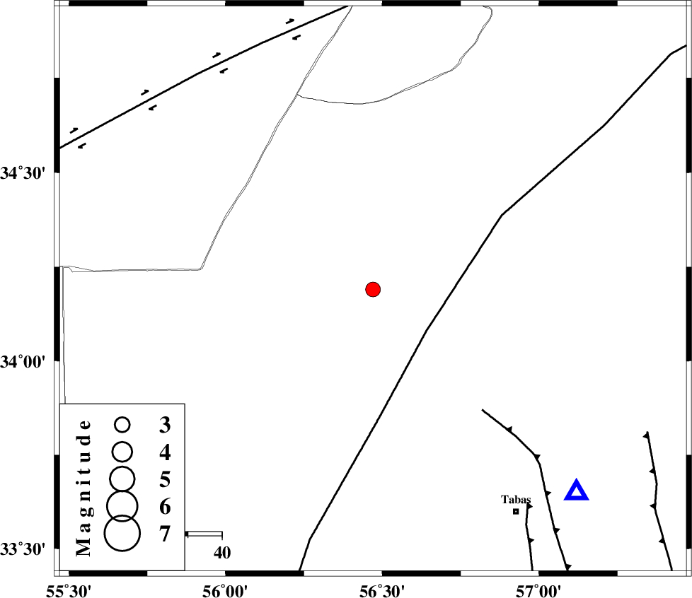
| Location | Lat:34.19 Lon: 56.47 |
| Region | Yazd Province, 78 km North-West of Tabas |
Nearest Cities |
|
| 32 km North East of Halvan, Yazd Province | |
| 46 km South West of Eshqabad, Yazd Province | |
| 59 km North West of Jokhvah, Yazd Province | |
| 70 km North East of Darin, Yazd Province | |
| 78 km North West of Tabas, Yazd Province | |
| Depth | 14 km |
| Agency | |
Faults within 150 km: |
|
| NAINI_F (Length: 342 km) , Distance to epicenter: 20 km | |
| TABAS_F1 (Length: 91 km) , Distance to epicenter: 48 km | |
| TABAS_F2 (Length: 67 km) , Distance to epicenter: 78 km | |
| Number of Phases | 5 |
| RMS | 0.1 |
| Number of Stations | 4 |
| Error in Latitude | >4.1 km |
| Error in Longitude | 2.2 km |
| Error in Depth | 5.5 km |
Download waveform in seisan format
to download seisan software Click here
to access information about IIEES stations Click here
Amplitude | ||||||||
| UID | Agency | Station | Component | Amplitude | Period | Arrival Time | Proccessing Time | Signal Clip |
| 93683 | IIEES | YZKH | N | 76.3 | 0.41 | 2014-09-24 05:48:44 | 2014-09-24 06:21:00 | n |
Phase | ||||||||||||
| Agency | Station | Component | Phase Type | Phase Quality | First Motion | Observed Arrival Time | Time Residual | Loc. Flag | Input Weight | Distance | Azimuth | |
| IIEES | TABS | Z | Pg | E | 2014-09-24 05:47:37 | 0.05 | y | 84.5 | 135 | |||
| IIEES | YZKH | Z | Pn | E | 2014-09-24 05:48:04 | 0.14 | y | 265 | 222 | |||
| IIEES | YZKH | N | Sg | E | 2014-09-24 05:48:38 | -0.1 | y | 265 | 222 | |||
| IIEES | BSRN | Z | Pn | E | 2014-09-24 05:48:14 | -0.16 | y | 349 | 134 | |||
| IIEES | KRBR | N | Sg | E | 2014-09-24 05:49:33 | 0.07 | y | 467 | 177 | |||