
Magnitude |
:3.3 |
| Date & Time (UTC) | 2014-09-23 22:40:21.3 |
| Date & Time (Local) | 1393/7/2 02:10:21.3 |
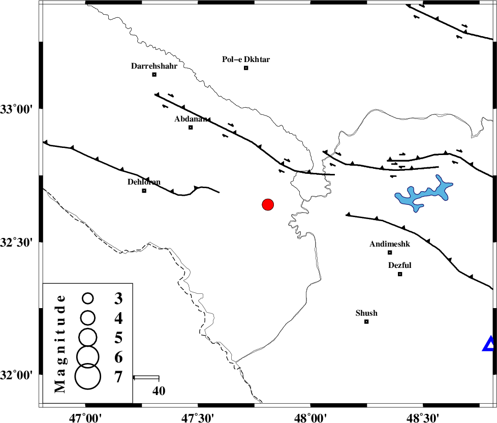
| Location | Lat:32.64 Lon: 47.81 |
| Region | Ilam Province, 52 km East of Dehloran |
Nearest Cities |
|
| 37 km South East of Sarabbagh, Ilam Province | |
| 41 km West of Hoseinieh, Khoozestan Province | |
| 42 km South West of Bidruyeh, Khoozestan Province | |
| 43 km North East of Musian, Ilam Province | |
| 45 km South East of Abdanan, Ilam Province | |
| Depth | 14 km |
| Agency | |
Faults within 150 km: |
|
| BALARUD_F_Z1 (Length: 87 km) , Distance to epicenter: 18 km | |
| MFF6 (Length: 144 km) , Distance to epicenter: 21 km | |
| BALARUD_F_Z3 (Length: 53 km) , Distance to epicenter: 32 km | |
| Number of Phases | 4 |
| RMS | 0.2 |
| Number of Stations | 3 |
| Error in Latitude | >10.7 km |
| Error in Longitude | 11.9 km |
| Error in Depth | 10.4 km |
Download waveform in seisan format
to download seisan software Click here
to access information about IIEES stations Click here
Amplitude | ||||||||
| UID | Agency | Station | Component | Amplitude | Period | Arrival Time | Proccessing Time | Signal Clip |
| 93672 | IIEES | SNGE | N | 141.5 | 0.76 | 2014-09-23 22:41:42 | 2014-09-24 03:05:00 | n |
Phase | ||||||||||||
| Agency | Station | Component | Phase Type | Phase Quality | First Motion | Observed Arrival Time | Time Residual | Loc. Flag | Input Weight | Distance | Azimuth | |
| IIEES | KHMZ | Z | Pg | E | 2014-09-23 22:40:59 | -0.14 | y | 235 | 58 | |||
| IIEES | SNGE | Z | Pn | E | 2014-09-23 22:41:03 | -0.14 | y | 275 | 351 | |||
| IIEES | SNGE | N | Sg | E | 2014-09-23 22:41:39 | 0.04 | y | 275 | 351 | |||
| IIEES | ASAO | Z | Pn | E | 2014-09-23 22:41:06 | 0.25 | y | 295 | 44 | |||