
Magnitude |
:2.7 |
| Date & Time (UTC) | 2014-09-19 19:08:13.8 |
| Date & Time (Local) | 1393/6/28 23:38:13.8 |
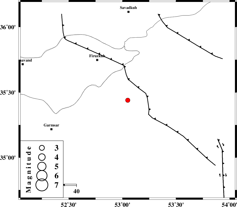
| Location | Lat:35.44 Lon: 53.05 |
| Region | Semnan Province, 35 km South-West of Semnan |
Nearest Cities |
|
| 5 km North of Lasjerd, Semnan Province | |
| 15 km West of Sorkheh, Semnan Province | |
| 19 km South of Aftar, Semnan Province | |
| 35 km South West of Semnan, Semnan Province | |
| 39 km South West of Mehdishahr, Semnan Province | |
| Depth | 14 km |
| Agency | |
Faults within 150 km: |
|
| KUH_E_GACHAB_F2 (Length: 31 km) , Distance to epicenter: 22 km | |
| ATARI_F (Length: 185 km) , Distance to epicenter: 27 km | |
| KUH_E_GACHAB_F1 (Length: 53 km) , Distance to epicenter: 30 km | |
| Number of Phases | 6 |
| RMS | 0.1 |
| Number of Stations | 5 |
| Error in Latitude | >4 km |
| Error in Longitude | 5.7 km |
| Error in Depth | 4.3 km |
Download waveform in seisan format
to download seisan software Click here
to access information about IIEES stations Click here
Amplitude | ||||||||
| UID | Agency | Station | Component | Amplitude | Period | Arrival Time | Proccessing Time | Signal Clip |
| 93642 | IIEES | THKV | N | 75.8 | 0.28 | 2014-09-19 19:09:16 | 2014-09-19 07:40:00 | n |
Phase | ||||||||||||
| Agency | Station | Component | Phase Type | Phase Quality | First Motion | Observed Arrival Time | Time Residual | Loc. Flag | Input Weight | Distance | Azimuth | |
| IIEES | DAMV | Z | Pg | E | 2014-09-19 19:08:31 | 0.01 | y | 100 | 282 | |||
| IIEES | DAMV | E | Sg | E | 2014-09-19 19:08:44 | -0.01 | y | 100 | 282 | |||
| IIEES | CHTH | Z | Pn | E | 2014-09-19 19:08:44 | -0.13 | y | 182 | 287 | |||
| IIEES | GHVR | Z | Pn | E | 2014-09-19 19:08:45 | -0.04 | y | 196 | 238 | |||
| IIEES | THKV | Z | Pn | E | 2014-09-19 19:08:47 | 0.13 | y | 204 | 286 | |||
| IIEES | ASAO | Z | Pn | E | 2014-09-19 19:08:58 | 0.06 | y | 294 | 251 | |||