
Magnitude |
:2.4 |
| Date & Time (UTC) | 2014-09-19 06:58:01.7 |
| Date & Time (Local) | 1393/6/28 11:28:01.7 |
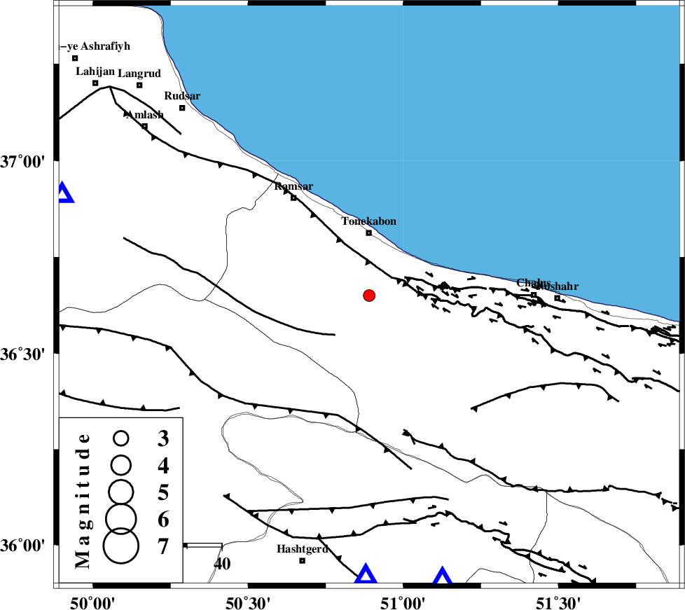
| Location | Lat:36.65 Lon: 50.89 |
| Region | Mazandaran Province, 19 km South of Tonekabon |
Nearest Cities |
|
| 11 km of Kanza, Mazandaran Province | |
| 15 km South of Khorramabad, Mazandaran Province | |
| 17 km South of Soleymanabad, Mazandaran Province | |
| 18 km South of Tonekabon, Mazandaran Province | |
| 21 km West of Abbasabad, Mazandaran Province | |
| Depth | 14 km |
| Agency | |
Faults within 150 km: |
|
| KHAZAR_F (Length: 523 km) , Distance to epicenter: 8 km | |
| N_ALBORZ_F (Length: 360 km) , Distance to epicenter: 8 km | |
| BONAN_F (Length: 74 km) , Distance to epicenter: 15 km | |
| Number of Phases | 6 |
| RMS | 0.4 |
| Number of Stations | 3 |
| Error in Latitude | >8.4 km |
| Error in Longitude | 8.6 km |
| Error in Depth | 14.4 km |
Download waveform in seisan format
to download seisan software Click here
to access information about IIEES stations Click here
Amplitude | ||||||||
| UID | Agency | Station | Component | Amplitude | Period | Arrival Time | Proccessing Time | Signal Clip |
| 93639 | IIEES | THKV | N | 151.4 | 0.38 | 2014-09-19 06:58:28 | 2014-09-19 09:41:00 | n |
Phase | ||||||||||||
| Agency | Station | Component | Phase Type | Phase Quality | First Motion | Observed Arrival Time | Time Residual | Loc. Flag | Input Weight | Distance | Azimuth | |
| IIEES | THKV | Z | Pg | E | 2014-09-19 06:58:15 | -0.63 | y | 81.1 | 181 | |||
| IIEES | THKV | N | Sg | E | 2014-09-19 06:58:26 | 0.3 | y | 81.1 | 181 | |||
| IIEES | CHTH | Z | Pg | E | 2014-09-19 06:58:16 | -0.07 | y | 84.8 | 165 | |||
| IIEES | CHTH | Z | Sg | E | 2014-09-19 06:58:27 | 0.11 | y | 84.8 | 165 | |||
| IIEES | ZNJK | Z | Pn | E | 2014-09-19 06:58:34 | 0.5 | y | 197 | 271 | |||
| IIEES | ZNJK | E | Sg | E | 2014-09-19 06:58:57 | -0.21 | y | 197 | 271 | |||