
Magnitude |
:3.3 |
| Date & Time (UTC) | 2014-09-15 07:08:04.8 |
| Date & Time (Local) | 1393/6/24 11:38:04.8 |
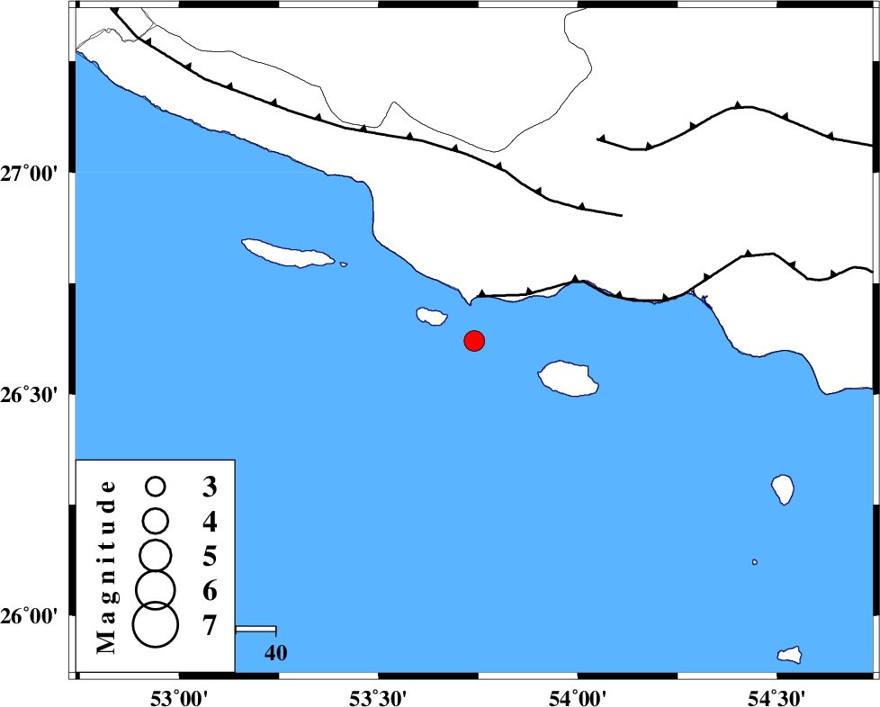
| Location | Lat:26.62 Lon: 53.74 |
| Region | Persian Gulf, 89 km South-West of Bastak |
Nearest Cities |
|
| 61 km South of Ahl, Fars Province | |
| 68 km South East of Ashkenan, Fars Province | |
| 70 km South West of Jenah, Hormozgan Province | |
| 89 km South West of Bastak, Hormozgan Province | |
| 92 km South East of Beyram, Fars Province | |
| Depth | 16 km |
| Agency | |
Faults within 150 km: |
|
| ZFF1 (Length: 165 km) , Distance to epicenter: 11 km | |
| MFF3 (Length: 292 km) , Distance to epicenter: 40 km | |
| MFF1 (Length: 180 km) , Distance to epicenter: 59 km | |
| Number of Phases | 5 |
| RMS | 0 |
| Number of Stations | 3 |
| Error in Latitude | >5 km |
| Error in Longitude | 2.6 km |
| Error in Depth | 5.9 km |
Download waveform in seisan format
to download seisan software Click here
to access information about IIEES stations Click here
Amplitude | ||||||||
| UID | Agency | Station | Component | Amplitude | Period | Arrival Time | Proccessing Time | Signal Clip |
| 93599 | IIEES | AHRM | N | 91.2 | 0.66 | 2014-09-15 07:10:04 | 2014-09-16 08:24:00 | n |
Phase | ||||||||||||
| Agency | Station | Component | Phase Type | Phase Quality | First Motion | Observed Arrival Time | Time Residual | Loc. Flag | Input Weight | Distance | Azimuth | |
| IIEES | BNDS | Z | Pn | E | 2014-09-15 07:08:44 | 0.01 | y | 257 | 70 | |||
| IIEES | BNDS | N | Sn | 2014-09-15 07:09:13 | 0.01 | y | 257 | 70 | ||||
| IIEES | AHRM | Z | Pn | E | 2014-09-15 07:08:55 | 0 | y | 346 | 317 | |||
| IIEES | AHRM | N | Sg | E | 2014-09-15 07:09:41 | 0.01 | y | 346 | 317 | |||
| IIEES | KRBR | Z | Pn | E | 2014-09-15 07:09:11 | -0.04 | y | 476 | 38 | |||