
Magnitude |
:3 |
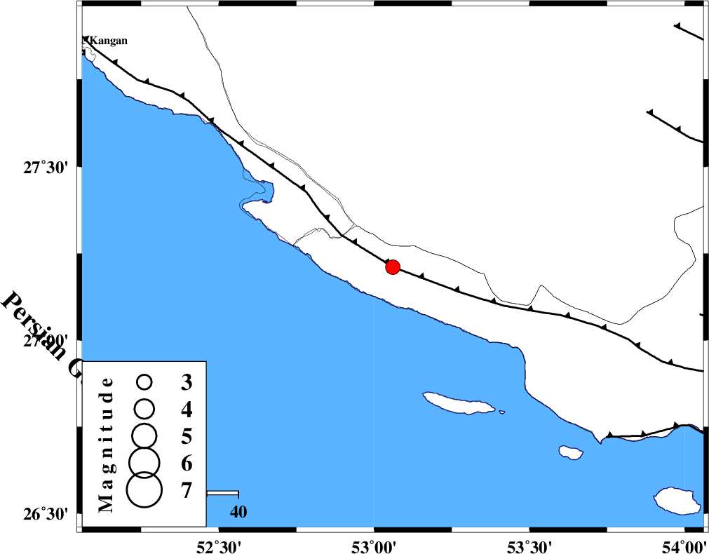
| Date & Time (UTC) | 2014-09-13 00:29:12.9 |
| Date & Time (Local) | 1393/6/22 04:59:12.9 |
| Location | Lat:27.21 Lon: 53.06 |
| Region | Hormozgan Province, 17 km South-West of Lamerd |
Nearest Cities |
|
| 17 km South West of Lamerd, Fars Province | |
| 28 km South of Khoozi, Fars Province | |
| 32 km South East of Chah-e mobarak, Bushehr Province | |
| 41 km South East of Mehr, Fars Province | |
| 47 km South of Alamarvdasht, Fars Province | |
| Depth | 18 km |
| Agency | |
Faults within 150 km: |
|
| MFF3 (Length: 292 km) , Distance to epicenter: 0 km | |
| ZFF1 (Length: 165 km) , Distance to epicenter: 87 km | |
| LAR_F (Length: 99 km) , Distance to epicenter: 95 km | |
| Number of Phases | 7 |
| RMS | 0.3 |
| Number of Stations | 4 |
| Error in Latitude | >7.4 km |
| Error in Longitude | 3.6 km |
| Error in Depth | 5.6 km |
Download waveform in seisan format
to download seisan software Click here
to access information about IIEES stations Click here
Amplitude | ||||||||
| UID | Agency | Station | Component | Amplitude | Period | Arrival Time | Proccessing Time | Signal Clip |
| 93584 | IIEES | AHRM | N | 87.8 | 0.66 | 2014-09-13 00:30:37 | 2014-09-14 09:04:00 | n |
Phase | ||||||||||||
| Agency | Station | Component | Phase Type | Phase Quality | First Motion | Observed Arrival Time | Time Residual | Loc. Flag | Input Weight | Distance | Azimuth | |
| IIEES | AHRM | Z | Pn | E | 2014-09-13 00:29:51 | -0.33 | y | 252 | 317 | |||
| IIEES | AHRM | N | Sg | E | 2014-09-13 00:30:24 | 0.12 | y | 252 | 317 | |||
| IIEES | BNDS | Z | Pn | E | 2014-09-13 00:29:58 | 0.03 | y | 309 | 85 | |||
| IIEES | BNDS | N | Sg | E | 2014-09-13 00:30:39 | -0.08 | y | 309 | 85 | |||
| IIEES | KRBR | Z | Pn | E | 2014-09-13 00:30:20 | 0.76 | y | 475 | 49 | |||
| IIEES | KRBR | N | Sn | 2014-09-13 00:31:07 | -0.24 | y | 475 | 49 | ||||
| IIEES | YZKH | Z | Pn | E | 2014-09-13 00:30:33 | -0.19 | y | 593 | 14 | |||