
Magnitude |
:2.8 |
| Date & Time (UTC) | 2014-09-01 05:59:11.2 |
| Date & Time (Local) | 1393/6/10 10:29:11.2 |
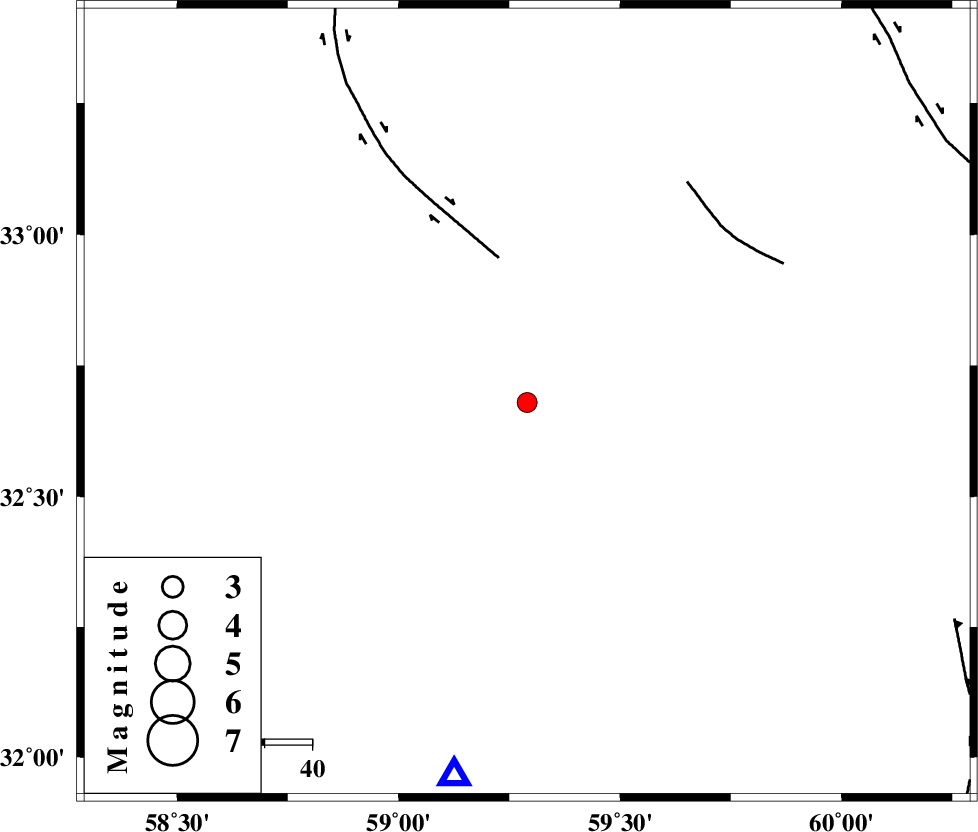
| Location | Lat:32.68 Lon: 59.29 |
| Region | Khorasan(south) Province, 25 km South of Birjand |
Nearest Cities |
|
| 9 km of Gol, Khorasan(south) Province | |
| 11 km North of Gaz, Khorasan(south) Province | |
| 22 km West of Mud, Khorasan(south) Province | |
| 24 km North West of Kalateh soleyman, Khorasan(south) Province | |
| 25 km South of Birjand, Khorasan(south) Province | |
| Depth | 7 km |
| Agency | |
Faults within 150 km: |
|
| MOHAMMADABAD_F (Length: 71 km) , Distance to epicenter: 31 km | |
| NOZAD_F (Length: 27 km) , Distance to epicenter: 55 km | |
| FERDOWS_F (Length: 101 km) , Distance to epicenter: 98 km | |
| Number of Phases | 5 |
| RMS | 0.1 |
| Number of Stations | 4 |
| Error in Latitude | >2.5 km |
| Error in Longitude | 7 km |
| Error in Depth | 7.6 km |
Download waveform in seisan format
to download seisan software Click here
to access information about IIEES stations Click here
Amplitude | ||||||||
| UID | Agency | Station | Component | Amplitude | Period | Arrival Time | Proccessing Time | Signal Clip |
| 93437 | IIEES | SHRT | N | 157.1 | 0.28 | 2014-09-01 05:59:56 | 2014-09-01 07:41:00 | n |
Phase | ||||||||||||
| Agency | Station | Component | Phase Type | Phase Quality | First Motion | Observed Arrival Time | Time Residual | Loc. Flag | Input Weight | Distance | Azimuth | |
| IIEES | BSRN | Z | Pg | E | 2014-09-01 05:59:25 | -0.15 | y | 80.9 | 191 | |||
| IIEES | BSRN | N | Sg | E | 2014-09-01 05:59:36 | 0.12 | y | 80.9 | 191 | |||
| IIEES | SHRT | Z | Pg | E | 2014-09-01 05:59:35 | 0.03 | y | 142 | 41 | |||
| IIEES | TABS | Z | Pn | E | 2014-09-01 05:59:48 | 0.04 | y | 229 | 299 | |||
| IIEES | KRBR | Z | Pn | E | 2014-09-01 06:00:07 | -0.04 | y | 384 | 219 | |||