
Magnitude |
:3.5 |
| Date & Time (UTC) | 2014-08-24 23:06:04.1 |
| Date & Time (Local) | 1393/6/3 03:36:04.1 |
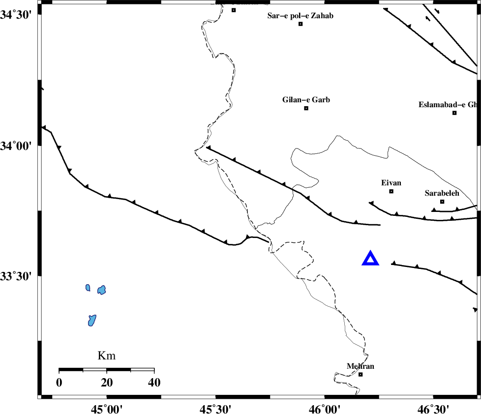
| Location | Lat:33.79 Lon: 45.7 |
| Region | Kermanshah Province, 44 km South-West of Gilan-E-Gharb |
Nearest Cities |
|
| 11 km of Sumar, Kermanshah Province | |
| 36 km South West of Nian, Kermanshah Province | |
| 43 km South West of Teran, Ilam Province | |
| 44 km South West of Gilan-E-Gharb, Kermanshah Province | |
| 47 km South West of Zarneh, Ilam Province | |
| Depth | 5 km |
| Agency | |
Faults within 150 km: |
|
| ZFF4 (Length: 128 km) , Distance to epicenter: 12 km | |
| MFF7 (Length: 99 km) , Distance to epicenter: 13 km | |
| MFF8 (Length: 48 km) , Distance to epicenter: 74 km | |
| Number of Phases | 7 |
| RMS | 0.1 |
| Number of Stations | 6 |
| Error in Latitude | >4.2 km |
| Error in Longitude | 7.3 km |
| Error in Depth | 7.6 km |
Download waveform in seisan format
to download seisan software Click here
to access information about IIEES stations Click here
Amplitude | ||||||||
| UID | Agency | Station | Component | Amplitude | Period | Arrival Time | Proccessing Time | Signal Clip |
| 93284 | IIEES | SHGR | E | 92.6 | 0.4 | 2014-08-24 23:07:55 | 2014-08-25 01:28:00 | n |
| 93285 | IIEES | SHGR | N | 108.5 | 0.56 | 2014-08-24 23:07:59 | 2014-08-25 01:28:00 | n |
| 93286 | IIEES | GHIR | E | 8.2 | 0.68 | 2014-08-24 23:09:41 | 2014-08-25 01:28:00 | n |
Phase | ||||||||||||
| Agency | Station | Component | Phase Type | Phase Quality | First Motion | Observed Arrival Time | Time Residual | Loc. Flag | Input Weight | Distance | Azimuth | |
| IIEES | SHGR | Z | Pn | E | 2014-08-24 23:06:55 | 0.02 | y | 345 | 122 | |||
| IIEES | KHMZ | Z | Pn | E | 2014-08-24 23:07:02 | -0.09 | y | 395 | 90 | |||
| IIEES | ASAO | Z | Pn | E | 2014-08-24 23:07:03 | 0.12 | y | 408 | 77 | |||
| IIEES | ASAO | N | S | E | 2014-08-24 23:07:47 | 0.07 | y | 408 | 77 | |||
| IIEES | GHVR | Z | Pn | E | 2014-08-24 23:07:16 | -0.19 | y | 517 | 80 | |||
| IIEES | GRMI | Z | Pn | E | 2014-08-24 23:07:26 | 0.15 | y | 591 | 19 | |||
| IIEES | GRMI | E | S | E | 2014-08-24 23:08:26 | -0.09 | y | 591 | 19 | |||