
Magnitude |
:2.1 |
| Date & Time (UTC) | 2014-08-16 10:47:10.0 |
| Date & Time (Local) | 1393/5/25 15:17:10.0 |
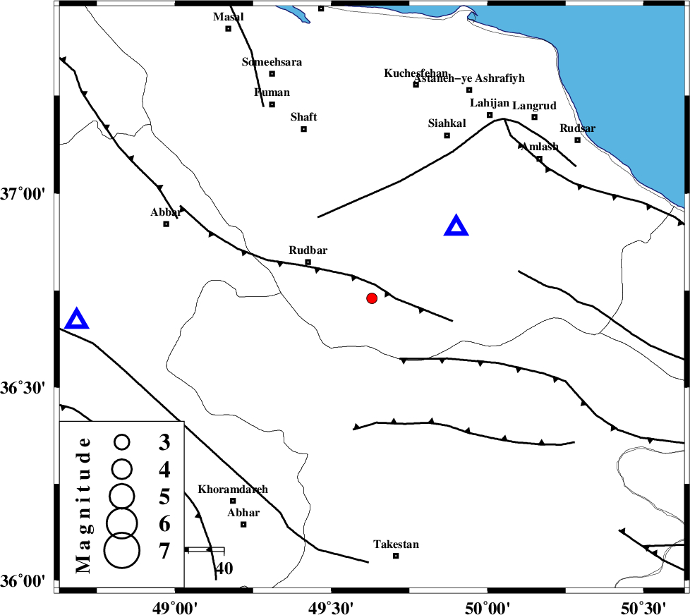
| Location | Lat:36.73 Lon: 49.63 |
| Region | Gilan Province, 21 km East of Rudbar |
Nearest Cities |
|
| 14 km North West of Jirhandeh, Gilan Province | |
| 15 km South of Dashtvil, Gilan Province | |
| 16 km North East of Loshan, Gilan Province | |
| 19 km North of Kuhgir-e sofla, Ghazvin Province | |
| 20 km South East of Rostamabad, Gilan Province | |
| Depth | 15 km |
| Agency | |
Faults within 150 km: |
|
| RUDBAR_F (Length: 93 km) , Distance to epicenter: 4 km | |
| ALAMUTRUD_F (Length: 140 km) , Distance to epicenter: 19 km | |
| LAHIJAN_F (Length: 92 km) , Distance to epicenter: 28 km | |
| Number of Phases | 4 |
| RMS | 0 |
| Number of Stations | 3 |
| Error in Latitude | >4.7 km |
| Error in Longitude | 5 km |
| Error in Depth | 11 km |
Download waveform in seisan format
to download seisan software Click here
to access information about IIEES stations Click here
Amplitude | ||||||||
| UID | Agency | Station | Component | Amplitude | Period | Arrival Time | Proccessing Time | Signal Clip |
| 92942 | IIEES | GRMI | N | 7.5 | 0.2 | 2014-08-16 10:48:27 | 2014-08-16 12:52:00 | n |
| 92943 | IIEES | GRMI | E | 8.9 | 0.28 | 2014-08-16 10:48:28 | 2014-08-16 12:52:00 | n |
Phase | ||||||||||||
| Agency | Station | Component | Phase Type | Phase Quality | First Motion | Observed Arrival Time | Time Residual | Loc. Flag | Input Weight | Distance | Azimuth | |
| IIEES | ZNJK | Z | Pg | E | 2014-08-16 10:47:24 | -0.01 | y | 84.7 | 266 | |||
| IIEES | ZNJK | E | Sg | E | 2014-08-16 10:47:35 | 0.01 | y | 84.7 | 266 | |||
| IIEES | CHTH | Z | Pn | E | 2014-08-16 10:47:37 | 0 | y | 162 | 124 | |||
| IIEES | GRMI | Z | Pn | E | 2014-08-16 10:47:52 | 0 | y | 277 | 327 | |||