
Magnitude |
:3.4 |
| Date & Time (UTC) | 2014-08-14 17:25:13.0 |
| Date & Time (Local) | 1393/5/23 21:55:13.0 |
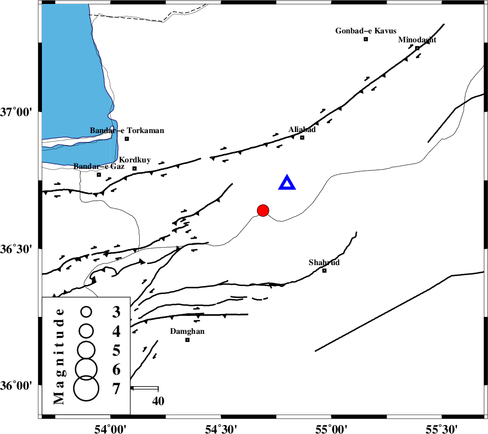
| Location | Lat:36.64 Lon: 54.69 |
| Region | Golestan Province, 33 km South-West of Ali Abad |
Nearest Cities |
|
| 19 km North of Majen, Semnan Province | |
| 23 km East of Naharkhoran, Golestan Province | |
| 23 km North East of Cheharbagh, Golestan Province | |
| 26 km South East of Jalin olia, Golestan Province | |
| 31 km South East of Gorgan, Golestan Province | |
| Depth | 18 km |
| Agency | |
Faults within 150 km: |
|
| SHAVAR_F (Length: 87 km) , Distance to epicenter: 10 km | |
| ASTANEH_F (Length: 72 km) , Distance to epicenter: 19 km | |
| N_ALBORZ_F (Length: 360 km) , Distance to epicenter: 27 km | |
| Number of Phases | 5 |
| RMS | 0.1 |
| Number of Stations | 4 |
| Error in Latitude | >3.2 km |
| Error in Longitude | 2.6 km |
| Error in Depth | 6.8 km |
Download waveform in seisan format
to download seisan software Click here
to access information about IIEES stations Click here
Amplitude | ||||||||
| UID | Agency | Station | Component | Amplitude | Period | Arrival Time | Proccessing Time | Signal Clip |
| 92933 | IIEES | CHTH | E | 122.8 | 0.64 | 2014-08-14 17:26:49 | 2014-08-14 08:47:00 | n |
Phase | ||||||||||||
| Agency | Station | Component | Phase Type | Phase Quality | First Motion | Observed Arrival Time | Time Residual | Loc. Flag | Input Weight | Distance | Azimuth | |
| IIEES | SHRO | E | Pn | E | 2014-08-14 17:25:37 | -0.04 | y | 138 | 120 | |||
| IIEES | BJRD | N | Pn | E | 2014-08-14 17:25:53 | -0.14 | y | 268 | 63 | |||
| IIEES | BJRD | E | Sg | E | 2014-08-14 17:26:28 | 0.09 | y | 268 | 63 | |||
| IIEES | CHTH | Z | Pn | E | 2014-08-14 17:26:01 | 0.04 | y | 330 | 257 | |||
| IIEES | YZKH | Z | Pn | E | 2014-08-14 17:26:19 | 0.06 | y | 472 | 181 | |||