
Magnitude |
:2.2 |
| Date & Time (UTC) | 2014-08-11 15:57:49.4 |
| Date & Time (Local) | 1393/5/20 20:27:49.4 |
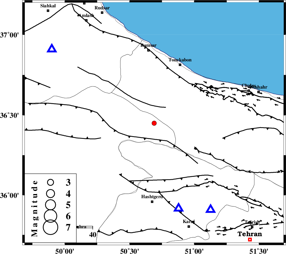
| Location | Lat:36.45 Lon: 50.69 |
| Region | Ghazvin Province, 50 km South of Ramsar |
Nearest Cities |
|
| 21 km North East of Moallemkelayeh, Ghazvin Province | |
| 30 km North of Shahrak, Tehran Province | |
| 30 km North of Taleqan, Tehran Province | |
| 32 km South East of Tamol, Mazandaran Province | |
| 38 km North East of Rajaeedasht, Ghazvin Province | |
| Depth | 18 km |
| Agency | |
Faults within 150 km: |
|
| BONAN_F (Length: 74 km) , Distance to epicenter: 12 km | |
| ALAMUTRUD_F (Length: 140 km) , Distance to epicenter: 12 km | |
| KANDOVAN_F (Length: 90 km) , Distance to epicenter: 30 km | |
| Number of Phases | 5 |
| RMS | 0.1 |
| Number of Stations | 3 |
| Error in Latitude | >3 km |
| Error in Longitude | 3.3 km |
| Error in Depth | 6.6 km |
Download waveform in seisan format
to download seisan software Click here
to access information about IIEES stations Click here
Amplitude | ||||||||
| UID | Agency | Station | Component | Amplitude | Period | Arrival Time | Proccessing Time | Signal Clip |
| 92927 | IIEES | ASAO | E | 16.1 | 0.36 | 2014-08-11 15:58:52 | 2014-08-12 03:31:00 | n |
| 92928 | IIEES | ASAO | N | 20.4 | 0.28 | 2014-08-11 15:58:52 | 2014-08-12 03:31:00 | n |
Phase | ||||||||||||
| Agency | Station | Component | Phase Type | Phase Quality | First Motion | Observed Arrival Time | Time Residual | Loc. Flag | Input Weight | Distance | Azimuth | |
| IIEES | CHTH | Z | Pg | E | 2014-08-11 15:58:02 | 0.02 | y | 71.9 | 147 | |||
| IIEES | CHTH | E | Sg | E | 2014-08-11 15:58:11 | 0.01 | y | 71.9 | 147 | |||
| IIEES | ZNJK | Z | Pn | E | 2014-08-11 15:58:19 | 0.14 | y | 181 | 278 | |||
| IIEES | ASAO | Z | Pn | E | 2014-08-11 15:58:23 | -0.21 | y | 220 | 196 | |||
| IIEES | ASAO | N | Sg | E | 2014-08-11 15:58:51 | 0.05 | y | 220 | 196 | |||