
Magnitude |
:2.9 |
| Date & Time (UTC) | 2014-07-28 16:30:39.4 |
| Date & Time (Local) | 1393/5/6 21:00:39.4 |
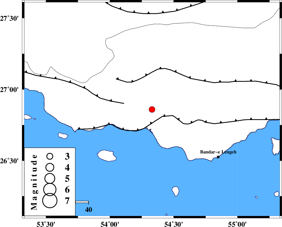
| Location | Lat:26.86 Lon: 54.33 |
| Region | Hormozgan Province, 38 km South of Bastak |
Nearest Cities |
|
| 18 km South of Jenah, Hormozgan Province | |
| 38 km South of Bastak, Hormozgan Province | |
| 64 km North West of Bandar-e lengeh, Hormozgan Province | |
| 68 km South East of Ahl, Fars Province | |
| 77 km South East of Bagh, Fars Province | |
| Depth | 18 km |
| Agency | |
Faults within 150 km: |
|
| ZFF1 (Length: 165 km) , Distance to epicenter: 9 km | |
| MFF3 (Length: 292 km) , Distance to epicenter: 22 km | |
| MFF1 (Length: 180 km) , Distance to epicenter: 26 km | |
| Number of Phases | 5 |
| RMS | 0 |
| Number of Stations | 3 |
| Error in Latitude | >8.5 km |
| Error in Longitude | 2.8 km |
| Error in Depth | 6.6 km |
Download waveform in seisan format
to download seisan software Click here
to access information about IIEES stations Click here
Amplitude | ||||||||
| UID | Agency | Station | Component | Amplitude | Period | Arrival Time | Proccessing Time | Signal Clip |
| 92876 | IIEES | BNDS | E | 99.4 | 0.56 | 2014-07-28 16:31:48 | 2014-07-29 12:36:00 | n |
| 92877 | IIEES | BNDS | N | 107.1 | 0.44 | 2014-07-28 16:31:51 | 2014-07-29 12:36:00 | n |
| 92878 | IIEES | GHIR | E | 127.5 | 0.48 | 2014-07-28 16:31:43 | 2014-07-29 12:36:00 | n |
| 92879 | IIEES | KRBR | N | 16.2 | 0.62 | 2014-07-28 16:32:31 | 2014-07-29 12:36:00 | n |
Phase | ||||||||||||
| Agency | Station | Component | Phase Type | Phase Quality | First Motion | Observed Arrival Time | Time Residual | Loc. Flag | Input Weight | Distance | Azimuth | |
| IIEES | BNDS | Z | Pn | E | 2014-07-28 16:31:10 | -0.03 | y | 192 | 71 | |||
| IIEES | BNDS | N | Sg | E | 2014-07-28 16:31:34 | 0.02 | y | 192 | 71 | |||
| IIEES | GHIR | Z | Pn | E | 2014-07-28 16:31:12 | 0.03 | y | 207 | 320 | |||
| IIEES | GHIR | E | Sg | E | 2014-07-28 16:31:38 | -0.01 | y | 207 | 320 | |||
| IIEES | KRBR | Z | Pn | E | 2014-07-28 16:31:39 | -0.02 | y | 420 | 34 | |||