
Magnitude |
:2.4 |
| Date & Time (UTC) | 2014-07-26 11:30:43.3 |
| Date & Time (Local) | 1393/5/4 16:00:43.3 |
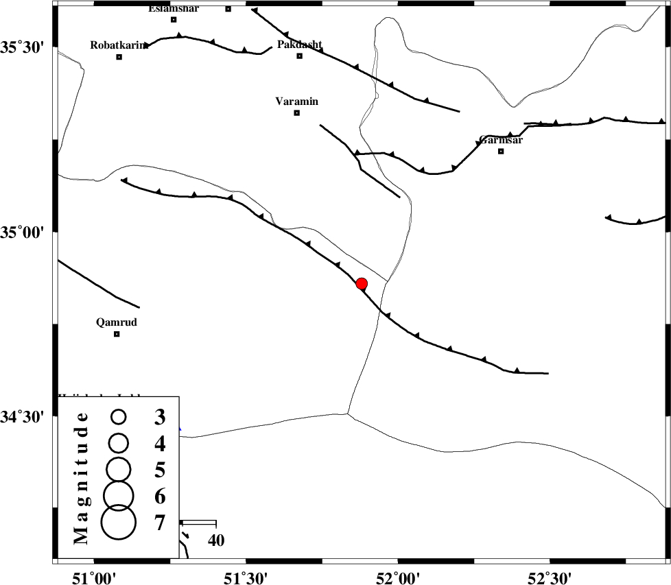
| Location | Lat:34.86 Lon: 51.88 |
| Region | Qom Province, 55 km South-East of Varamin |
Nearest Cities |
|
| 47 km South of Shorqazi, Semnan Province | |
| 49 km South West of Cheshmeh nadi, Semnan Province | |
| 51 km South East of Ab barik, Tehran Province | |
| 51 km South East of Pishva, Tehran Province | |
| 55 km South West of Lajran, Semnan Province | |
| Depth | 15 km |
| Agency | |
Faults within 150 km: |
|
| SIAHKUH_F (Length: 154 km) , Distance to epicenter: 6 km | |
| PISHAV_F (Length: 34 km) , Distance to epicenter: 28 km | |
| GARMSAR_F (Length: 77 km) , Distance to epicenter: 38 km | |
| Number of Phases | 4 |
| RMS | 0 |
| Number of Stations | 3 |
| Error in Latitude | >1.4 km |
| Error in Longitude | 9.2 km |
| Error in Depth | 4.1 km |
Download waveform in seisan format
to download seisan software Click here
to access information about IIEES stations Click here
Amplitude | ||||||||
| UID | Agency | Station | Component | Amplitude | Period | Arrival Time | Proccessing Time | Signal Clip |
| 92859 | IIEES | ASAO | E | 47.1 | 0.52 | 2014-07-26 11:31:40 | 2014-07-26 01:02:00 | n |
Phase | ||||||||||||
| Agency | Station | Component | Phase Type | Phase Quality | First Motion | Observed Arrival Time | Time Residual | Loc. Flag | Input Weight | Distance | Azimuth | |
| IIEES | GHVR | Z | Pg | E | 2014-07-26 11:30:55 | 0 | y | 72 | 234 | |||
| IIEES | CHTH | Z | Pg | E | 2014-07-26 11:31:05 | 0 | y | 135 | 330 | |||
| IIEES | CHTH | E | Sg | E | 2014-07-26 11:31:22 | 0 | y | 135 | 330 | |||
| IIEES | ASAO | Z | Pn | E | 2014-07-26 11:31:12 | 0 | y | 173 | 259 | |||