
Magnitude |
:2.6 |
| Date & Time (UTC) | 2014-07-26 06:59:52.9 |
| Date & Time (Local) | 1393/5/4 11:29:52.9 |
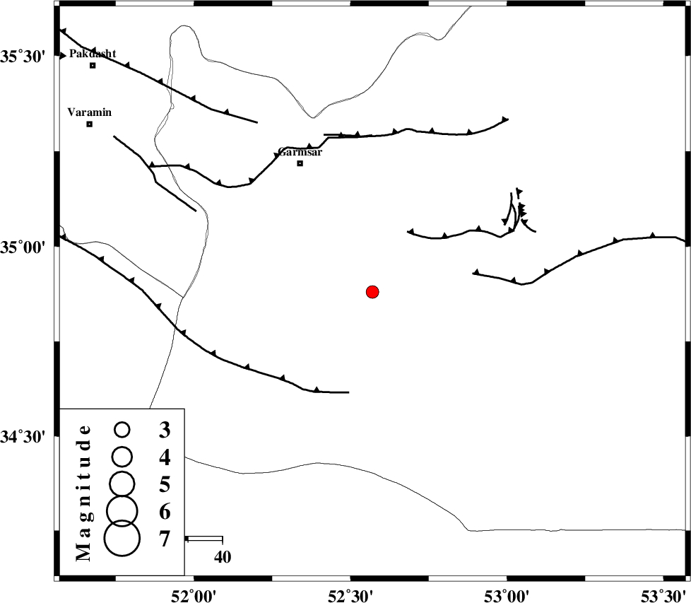
| Location | Lat:34.88 Lon: 52.57 |
| Region | Semnan Province, 43 km South-East of Garmsar |
Nearest Cities |
|
| 35 km South East of Gardovan, Semnan Province | |
| 38 km South of Davarabad, Semnan Province | |
| 39 km South of Kohanabad, Semnan Province | |
| 41 km South of Aradan, Semnan Province | |
| 41 km South East of Lajran, Semnan Province | |
| Depth | 21 km |
| Agency | |
Faults within 150 km: |
|
| KUH_E_GACHAB_F1 (Length: 53 km) , Distance to epicenter: 21 km | |
| SIAHKUH_F (Length: 154 km) , Distance to epicenter: 29 km | |
| KUH_E_GUGERD_F (Length: 73 km) , Distance to epicenter: 30 km | |
| Number of Phases | 6 |
| RMS | 0.2 |
| Number of Stations | 3 |
| Error in Latitude | >2.9 km |
| Error in Longitude | 6.3 km |
| Error in Depth | 8.2 km |
Download waveform in seisan format
to download seisan software Click here
to access information about IIEES stations Click here
Amplitude | ||||||||
| UID | Agency | Station | Component | Amplitude | Period | Arrival Time | Proccessing Time | Signal Clip |
| 92857 | IIEES | CHTH | E | 73.2 | 0.28 | 2014-07-26 07:00:43 | 2014-07-26 09:14:00 | n |
| 92858 | IIEES | ASAO | E | 40.9 | 0.59 | 2014-07-26 07:01:00 | 2014-07-26 09:14:00 | n |
Phase | ||||||||||||
| Agency | Station | Component | Phase Type | Phase Quality | First Motion | Observed Arrival Time | Time Residual | Loc. Flag | Input Weight | Distance | Azimuth | |
| IIEES | GHVR | Z | Pg | E | 2014-07-26 07:00:14 | 0.21 | y | 130 | 250 | |||
| IIEES | GHVR | E | Sg | E | 2014-07-26 07:00:29 | 0.1 | y | 130 | 250 | |||
| IIEES | CHTH | Z | Pg | E | 2014-07-26 07:00:20 | -0.29 | y | 174 | 311 | |||
| IIEES | CHTH | E | Sg | E | 2014-07-26 07:00:42 | 0.23 | y | 174 | 311 | |||
| IIEES | ASAO | Z | P | E | 2014-07-26 07:00:29 | 0.01 | y | 236 | 262 | |||
| IIEES | ASAO | E | Sg | E | 2014-07-26 07:00:58 | -0.27 | y | 236 | 262 | |||