
Magnitude |
:3.4 |
| Date & Time (UTC) | 2014-07-24 05:22:07.3 |
| Date & Time (Local) | 1393/5/2 09:52:07.3 |
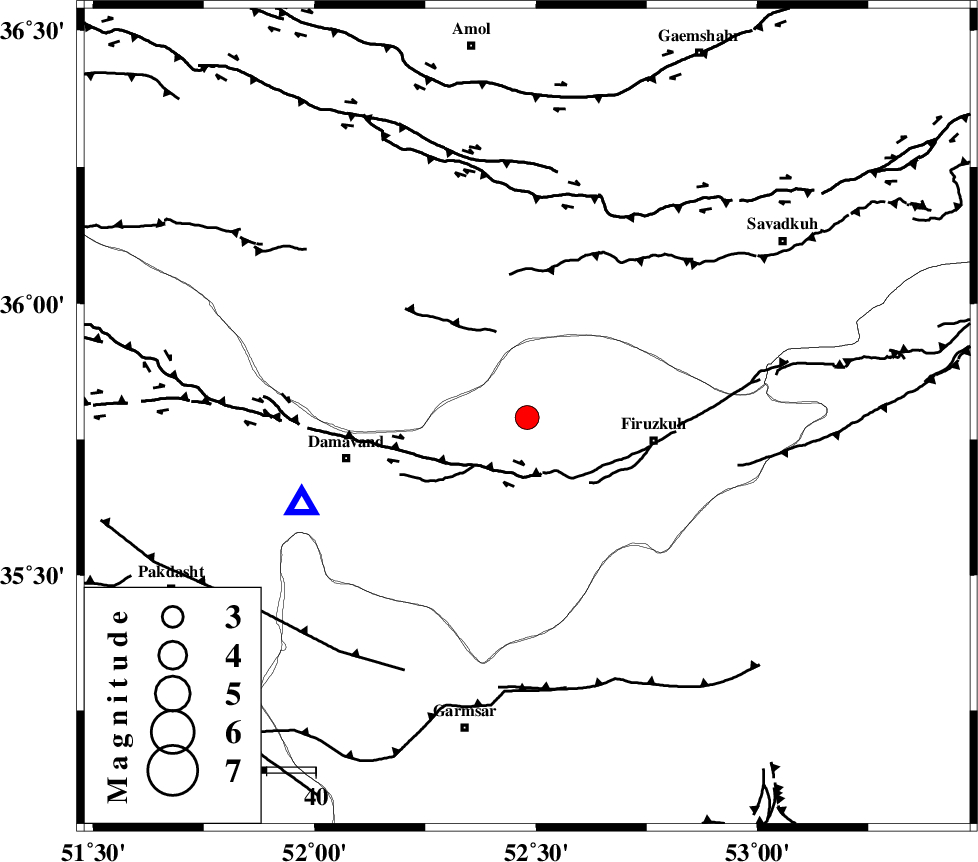
| Location | Lat:35.79 Lon: 52.48 |
| Region | Tehran Province, 26 km West of Firuzkuh |
Nearest Cities |
|
| 5 km of Arjomand, Tehran Province | |
| 19 km West of Shahrabad, Tehran Province | |
| 22 km North East of Sarbandan, Tehran Province | |
| 26 km North West of Firuzkuh, Tehran Province | |
| 26 km North West of Atashan, Tehran Province | |
| Depth | 14 km |
| Agency | |
Faults within 150 km: |
|
| MOSHA_F (Length: 234 km) , Distance to epicenter: 11 km | |
| ATARI_F (Length: 185 km) , Distance to epicenter: 44 km | |
| N_ALBORZ_F (Length: 360 km) , Distance to epicenter: 46 km | |
| Number of Phases | 7 |
| RMS | 0.2 |
| Number of Stations | 6 |
| Error in Latitude | >3.1 km |
| Error in Longitude | 5.1 km |
| Error in Depth | 7.3 km |
Download waveform in seisan format
to download seisan software Click here
to access information about IIEES stations Click here
Amplitude | ||||||||
| UID | Agency | Station | Component | Amplitude | Period | Arrival Time | Proccessing Time | Signal Clip |
| 92845 | IIEES | GHVR | E | 315.6 | 0.59 | 2014-07-24 05:23:06 | 2014-07-24 01:37:00 | n |
| 92846 | IIEES | ASAO | N | 209.6 | 0.38 | 2014-07-24 05:23:21 | 2014-07-24 01:37:00 | n |
| 92847 | IIEES | ASAO | E | 210 | 0.46 | 2014-07-24 05:23:22 | 2014-07-24 01:37:00 | n |
Phase | ||||||||||||
| Agency | Station | Component | Phase Type | Phase Quality | First Motion | Observed Arrival Time | Time Residual | Loc. Flag | Input Weight | Distance | Azimuth | |
| IIEES | CHTH | Z | Pg | E | 2014-07-24 05:22:27 | -0.21 | y | 123 | 276 | |||
| IIEES | GHVR | Z | Pn | E | 2014-07-24 05:22:37 | -0.28 | y | 184 | 218 | |||
| IIEES | GHVR | N | Sg | E | 2014-07-24 05:22:59 | -0.02 | y | 184 | 218 | |||
| IIEES | ASAO | Z | Pn | E | 2014-07-24 05:22:48 | 0.5 | y | 263 | 239 | |||
| IIEES | KHMZ | Z | Pn | E | 2014-07-24 05:22:55 | 0.02 | y | 324 | 226 | |||
| IIEES | TABS | Z | Pn | E | 2014-07-24 05:23:15 | -0.03 | y | 487 | 118 | |||
| IIEES | GRMI | Z | Pn | E | 2014-07-24 05:23:20 | 0.05 | y | 527 | 311 | |||