
Magnitude |
:2.8 |
| Date & Time (UTC) | 2014-07-22 14:25:23.5 |
| Date & Time (Local) | 1393/4/31 18:55:23.5 |
| Location | Lat:32.55 Lon: 48.61 |
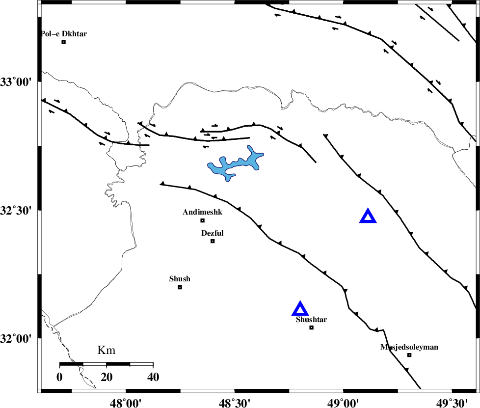
| Region | Khoozestan Province, 26 km East of Andimeshk |
Nearest Cities |
|
| 18 km North of Mahur berenji, Khoozestan Province | |
| 22 km North West of Sardasht, Khoozestan Province | |
| 26 km North East of Andimeshk, Khoozestan Province | |
| 28 km North East of Dezful, Khoozestan Province | |
| 33 km North East of Shamsabad, Khoozestan Province | |
| Depth | 14 km |
| Agency | |
Faults within 150 km: |
|
| DEZFUL_EMBAYMENT (Length: 228 km) , Distance to epicenter: 10 km | |
| BALARUD_F_Z3 (Length: 53 km) , Distance to epicenter: 26 km | |
| BALARUD_F_Z2 (Length: 58 km) , Distance to epicenter: 28 km | |
| Number of Phases | 6 |
| RMS | 0.2 |
| Number of Stations | 4 |
| Error in Latitude | >1.6 km |
| Error in Longitude | 6.2 km |
| Error in Depth | 6.6 km |
Download waveform in seisan format
to download seisan software Click here
to access information about IIEES stations Click here
Amplitude | ||||||||
| UID | Agency | Station | Component | Amplitude | Period | Arrival Time | Proccessing Time | Signal Clip |
| 92832 | IIEES | SHGR | N | 760.2 | 0.52 | 2014-07-22 14:25:42 | 2014-07-22 03:54:00 | n |
| 92833 | IIEES | SHGR | E | 839.2 | 0.48 | 2014-07-22 14:25:42 | 2014-07-22 03:54:00 | n |
Phase | ||||||||||||
| Agency | Station | Component | Phase Type | Phase Quality | First Motion | Observed Arrival Time | Time Residual | Loc. Flag | Input Weight | Distance | Azimuth | |
| IIEES | SHGR | Z | Pg | E | 2014-07-22 14:25:32 | -0.27 | y | 51.9 | 159 | |||
| IIEES | SHGR | N | Sg | E | 2014-07-22 14:25:39 | 0.21 | y | 51.9 | 159 | |||
| IIEES | KHMZ | Z | Pn | E | 2014-07-22 14:25:53 | -0.22 | y | 183 | 43 | |||
| IIEES | ASAO | Z | Pn | E | 2014-07-22 14:26:03 | 0.22 | y | 258 | 30 | |||
| IIEES | ASAO | N | Sg | E | 2014-07-22 14:26:36 | 0.02 | y | 258 | 30 | |||
| IIEES | SNGE | Z | Pn | E | 2014-07-22 14:26:09 | 0.05 | y | 306 | 338 | |||