
Magnitude |
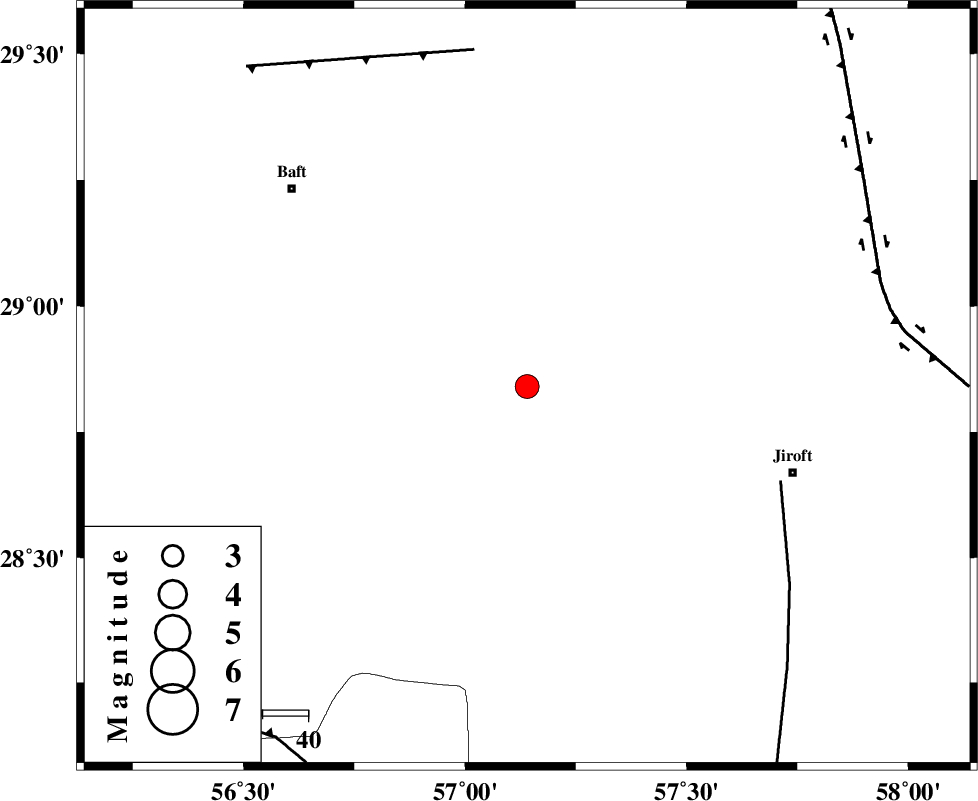
:3.4 |
| Date & Time (UTC) | 2014-07-15 18:42:05.1 |
| Date & Time (Local) | 1393/4/24 23:12:05.1 |
| Location | Lat:28.84 Lon: 57.14 |
| Region | Kerman Province, 62 km North-West of Jiroft |
Nearest Cities |
|
| 15 km North of Dolatabad, Kerman Province | |
| 27 km South West of Eslamabad, Kerman Province | |
| 47 km South West of Sahebabad, Kerman Province | |
| 48 km South West of Delfard, Kerman Province | |
| 51 km South East of Kahnuj, Kerman Province | |
| Depth | 46 km |
| Agency | |
Faults within 150 km: |
|
| SABZEVARAN_F (Length: 190 km) , Distance to epicenter: 60 km | |
| LALEHZAR_F (Length: 52 km) , Distance to epicenter: 75 km | |
| GOWK_F (Length: 152 km) , Distance to epicenter: 81 km | |
| Number of Phases | 5 |
| RMS | 0.1 |
| Number of Stations | 3 |
| Error in Latitude | >1.3 km |
| Error in Longitude | 2.8 km |
| Error in Depth | 2.5 km |
Download waveform in seisan format
to download seisan software Click here
to access information about IIEES stations Click here
Amplitude | ||||||||
| UID | Agency | Station | Component | Amplitude | Period | Arrival Time | Proccessing Time | Signal Clip |
| 92809 | IIEES | KRBR | E | 765.2 | 0.2 | 2014-07-15 18:42:46 | 2014-07-15 08:11:00 | n |
Phase | ||||||||||||
| Agency | Station | Component | Phase Type | Phase Quality | First Motion | Observed Arrival Time | Time Residual | Loc. Flag | Input Weight | Distance | Azimuth | |
| IIEES | KRBR | Z | Pn | E | 2014-07-15 18:42:26 | -0.1 | y | 132 | 344 | |||
| IIEES | KRBR | N | Sg | E | 2014-07-15 18:42:44 | 0.03 | y | 132 | 344 | |||
| IIEES | BNDS | Z | Pg | E | 2014-07-15 18:42:35 | 0.02 | y | 185 | 211 | |||
| IIEES | BSRN | Z | Pn | E | 2014-07-15 18:42:59 | 0.06 | y | 396 | 28 | |||
| IIEES | BSRN | N | Sg | E | 2014-07-15 18:43:53 | 0 | y | 396 | 28 | |||