
Magnitude |
:3.5 |
| Date & Time (UTC) | 2014-07-15 00:41:44.5 |
| Date & Time (Local) | 1393/4/24 05:11:44.5 |
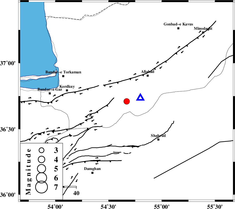
| Location | Lat:36.71 Lon: 54.67 |
| Region | Golestan Province, 25 km South-East of Gorgan |
Nearest Cities |
|
| 19 km South East of Jalin olia, Golestan Province | |
| 21 km North East of Naharkhoran, Golestan Province | |
| 25 km South East of Gorgan, Golestan Province | |
| 26 km North of Majen, Semnan Province | |
| 26 km North East of Cheharbagh, Golestan Province | |
| Depth | 15 km |
| Agency | |
Faults within 150 km: |
|
| SHAVAR_F (Length: 87 km) , Distance to epicenter: 18 km | |
| KHAZAR_F (Length: 523 km) , Distance to epicenter: 22 km | |
| ASTANEH_F (Length: 72 km) , Distance to epicenter: 26 km | |
| Number of Phases | 6 |
| RMS | 0.3 |
| Number of Stations | 6 |
| Error in Latitude | >4.8 km |
| Error in Longitude | 2 km |
| Error in Depth | 0 km |
Download waveform in seisan format
to download seisan software Click here
to access information about IIEES stations Click here
Amplitude | ||||||||
| UID | Agency | Station | Component | Amplitude | Period | Arrival Time | Proccessing Time | Signal Clip |
| 92800 | IIEES | GHVR | E | 99.6 | 0.72 | 2014-07-15 00:43:44 | 2014-07-15 03:39:00 | n |
Phase | ||||||||||||
| Agency | Station | Component | Phase Type | Phase Quality | First Motion | Observed Arrival Time | Time Residual | Loc. Flag | Input Weight | Distance | Azimuth | |
| IIEES | BJRD | N | Pn | E | 2014-07-15 00:42:25 | -0.04 | y | 267 | 65 | |||
| IIEES | GHVR | Z | Pn | E | 2014-07-15 00:42:41 | -0.13 | y | 396 | 232 | |||
| IIEES | TABS | Z | Pn | E | 2014-07-15 00:42:43 | 0.39 | y | 407 | 146 | |||
| IIEES | ASAO | Z | Pn | E | 2014-07-15 00:42:52 | -0.3 | y | 484 | 242 | |||
| IIEES | ZNJK | Z | Pn | E | 2014-07-15 00:42:59 | 0.37 | y | 534 | 271 | |||
| IIEES | SHRT | Z | Pn | E | 2014-07-15 00:43:08 | -0.36 | y | 615 | 122 | |||