
Magnitude |
:3.2 |
| Date & Time (UTC) | 2014-07-13 16:43:26.9 |
| Date & Time (Local) | 1393/4/22 21:13:26.9 |
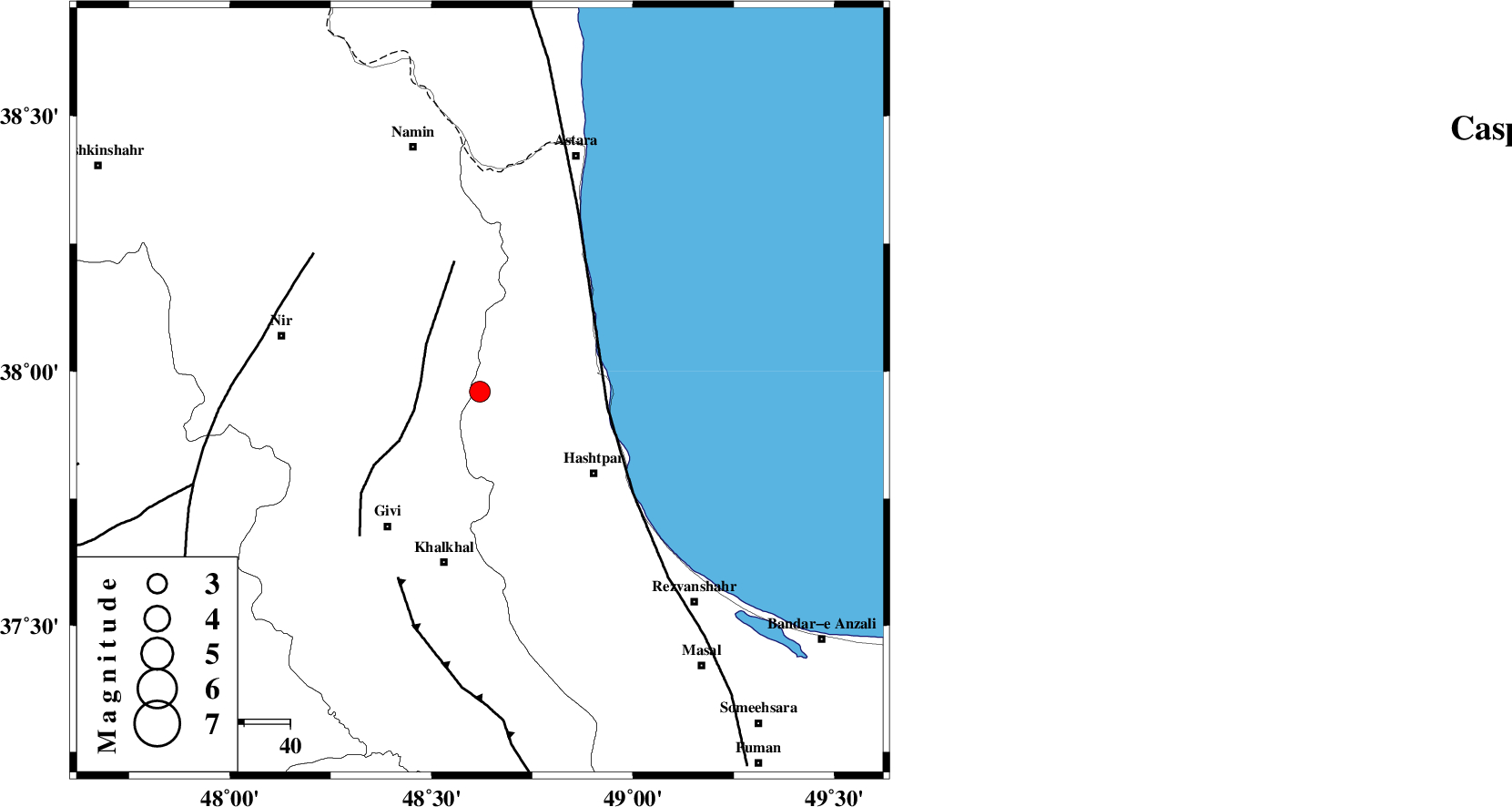
| Location | Lat:37.96 Lon: 48.62 |
| Region | Gilan Province, 38 km North of Khalkhal |
Nearest Cities |
|
| 20 km East of Budalalu, Ardebil Province | |
| 21 km South of Hir, Ardebil Province | |
| 22 km North West of Kish dini, Gilan Province | |
| 24 km South East of Mehmandust, Ardebil Province | |
| 27 km West of Lisar, Gilan Province | |
| Depth | 16 km |
| Agency | |
Faults within 150 km: |
|
| SANGAVAR_F (Length: 61 km) , Distance to epicenter: 13 km | |
| TALESH_F (Length: 258 km) , Distance to epicenter: 28 km | |
| MASULEL_F (Length: 90 km) , Distance to epicenter: 44 km | |
| Number of Phases | 5 |
| RMS | 0.1 |
| Number of Stations | 3 |
| Error in Latitude | >3.7 km |
| Error in Longitude | 14.2 km |
| Error in Depth | 14 km |
Download waveform in seisan format
to download seisan software Click here
to access information about IIEES stations Click here
Amplitude | ||||||||
| UID | Agency | Station | Component | Amplitude | Period | Arrival Time | Proccessing Time | Signal Clip |
| 92794 | IIEES | GRMI | N | 598.4 | 0.16 | 2014-07-13 16:44:00 | 2014-07-13 06:03:00 | n |
| 92795 | IIEES | GRMI | E | 505.8 | 0.16 | 2014-07-13 16:44:01 | 2014-07-13 06:03:00 | n |
Phase | ||||||||||||
| Agency | Station | Component | Phase Type | Phase Quality | First Motion | Observed Arrival Time | Time Residual | Loc. Flag | Input Weight | Distance | Azimuth | |
| IIEES | GRMI | Z | Pg | E | 2014-07-13 16:43:46 | -0.08 | y | 114 | 326 | |||
| IIEES | GRMI | N | Sg | E | 2014-07-13 16:44:00 | 0.05 | y | 114 | 326 | |||
| IIEES | ZNJK | Z | Pg | E | 2014-07-13 16:43:50 | 0.08 | y | 143 | 178 | |||
| IIEES | ZNJK | E | Sg | E | 2014-07-13 16:44:08 | -0.05 | y | 143 | 178 | |||
| IIEES | CHTH | Z | Pn | E | 2014-07-13 16:44:14 | 0 | y | 318 | 135 | |||