
Magnitude |
:3.3 |
| Date & Time (UTC) | 2014-07-11 04:52:30.4 |
| Date & Time (Local) | 1393/4/20 09:22:30.4 |
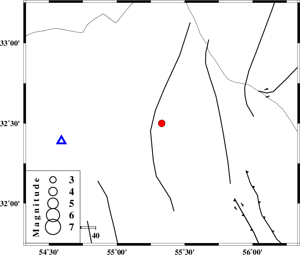
| Location | Lat:32.5 Lon: 55.33 |
| Region | Yazd Province, 100 km North of Bafq |
Nearest Cities |
|
| 61 km South West of Robat-e posht-e badam, Yazd Province | |
| 65 km North East of Kharaneq, Yazd Province | |
| 69 km South East of Zarrin, Yazd Province | |
| 77 km South East of Hajiabad, Yazd Province | |
| 86 km East of Tut, Yazd Province | |
| Depth | 17 km |
| Agency | |
Faults within 150 km: |
|
| POSHT_E_BADAM_F (Length: 128 km) , Distance to epicenter: 9 km | |
| SARBALA_F (Length: 92 km) , Distance to epicenter: 41 km | |
| ANAR_F (Length: 91 km) , Distance to epicenter: 60 km | |
| Number of Phases | 6 |
| RMS | 0.2 |
| Number of Stations | 4 |
| Error in Latitude | >3.3 km |
| Error in Longitude | 3.3 km |
| Error in Depth | 8.2 km |
Download waveform in seisan format
to download seisan software Click here
to access information about IIEES stations Click here
Amplitude | ||||||||
| UID | Agency | Station | Component | Amplitude | Period | Arrival Time | Proccessing Time | Signal Clip |
| 92779 | IIEES | KRBR | N | 106.8 | 0.44 | 2014-07-11 04:54:05 | 2014-07-11 06:26:00 | n |
Phase | ||||||||||||
| Agency | Station | Component | Phase Type | Phase Quality | First Motion | Observed Arrival Time | Time Residual | Loc. Flag | Input Weight | Distance | Azimuth | |
| IIEES | YZKH | Z | Pg | E | 2014-07-11 04:52:43 | 0.31 | y | 70.5 | 260 | |||
| IIEES | YZKH | N | Sg | E | 2014-07-11 04:52:51 | -0.24 | y | 70.5 | 260 | |||
| IIEES | TABS | Z | Pn | E | 2014-07-11 04:53:03 | -0.09 | y | 210 | 52 | |||
| IIEES | KRBR | Z | Pn | E | 2014-07-11 04:53:16 | 0.12 | y | 311 | 154 | |||
| IIEES | KRBR | N | Sg | E | 2014-07-11 04:53:57 | -0.07 | y | 311 | 154 | |||
| IIEES | BSRN | Z | Pn | E | 2014-07-11 04:53:22 | -0.04 | y | 363 | 98 | |||